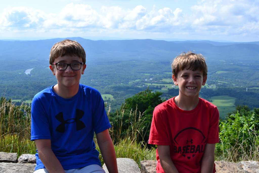
Until last summer, the last time we had driven to NJ was Christmas 2010. It was the last time because it took forever and both boys repeatedly threw up in the car. It was a miserable 12+ hour drive. We were already frequent fliers to NJ (it’s just more practical for our typically short visits) and that awful drive won us over to flying entirely. For the next 9 years all our visits were by air. But last summer I had a hankering for a road trip so we decided to plot out a course to NJ and on to Newport RI with stops along the way in VA.
On that trip, we broke from the usual I-85 to I-95 route north and took the western route along I-81. I did tons of research and plotted stops at Harpers Ferry WV, Luray Caverns, and Natural Bridge. It was a great trip and taking a big road trip with the boys checked off a box on our travel list. I loved the places we stopped and the boys were great car travelers. I’m so glad we did it. But I’ll be honest. I didn’t plan to do it again anytime soon.
But Covid-19 pretty much changed all travel plans for 2020. As we looked to break up a long, boring summer at home, we knew that spending time with our families would be key. We went to visit my in-laws in Ocean City MD first and then on to NJ. So the front end of the trip was naturally broken up but the return trip would be a straight shot home. When my husband’s work plans changed and he had to rent a car to drive back to Charlotte a week early, I knew I didn’t want to make that long trip all by myself in a single day.
So I went back to researching routes and stops. Washington DC is an obvious stop, but we had been there for spring break last year and I really preferred the more scenic and lightly trafficked western route along I-81. I was a little stuck because I didn’t want to repeat what we had done last summer (although Luray Caverns is still on my oldest’s all-time top 10 list of places we’ve been and he would have happily gone again) but I felt like with all the research I had done last summer, we had really already hit the highlights of that route.
But when I looked at a map of the route, something jumped out at me. The route along I-81 runs parallel to Shenandoah National Park. I quickly started researching and discovered it would be the perfect mid-way stopping point. I figured we could drive along Skyline drive, stopping at various overlooks, and take a short hike. The perfect way to stretch our legs after the long car ride.
Shenandoah National Park has a fantastic app that I highly recommend downloading if you are planning a visit. It was super helpful in planning the trip. I used it to choose which overlooks we would stop at and which hike we would take. Plus we used it while driving through the park to keep track of where we were and what was coming up.
The long and narrow Shenandoah National Park divides the Shenandoah Valley from the Virginia Piedmont. Perched amidst the Blue Ridge Mountains, the park covers almost 200,000 acres of wilderness with over 500 miles of hiking trails (including a 101 mile section of the Appalachian Trail). Interestingly, it is the only national park that was once private land. In the 1930s, the state of Virginia exercised its power of eminent domain to purchase property from around 5,000 landowners. The land was then donated to the federal government to create the national park.
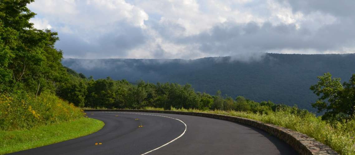
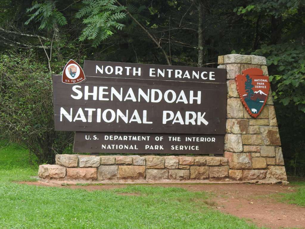
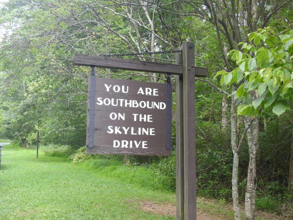
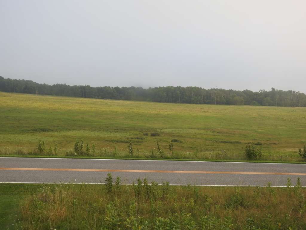
The entrance fee to the park is $30 per car and is valid for 7 consecutive days of entry. There are 4 entrance stations – Front Royal (North Entrance), Thornton Gap, Swift Run Gap, and Rockfish Gap (South Entrance). Since we were traveling from the north, we entered at the Front Royal station and headed south on Skyline Drive. Our plan was to hit several overlooks on our way to the Dark Hollow Falls Trail.
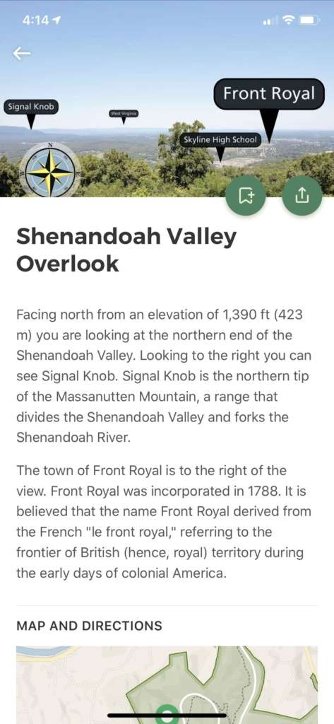
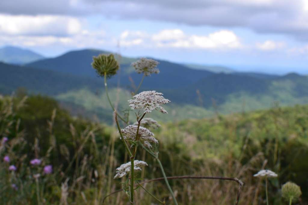
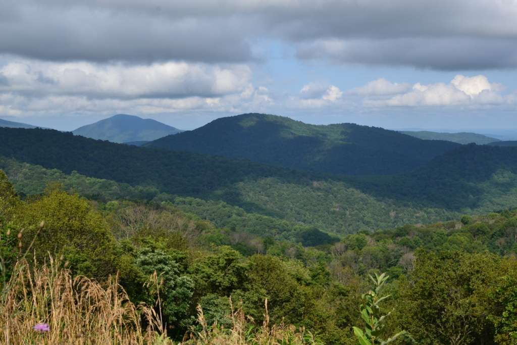
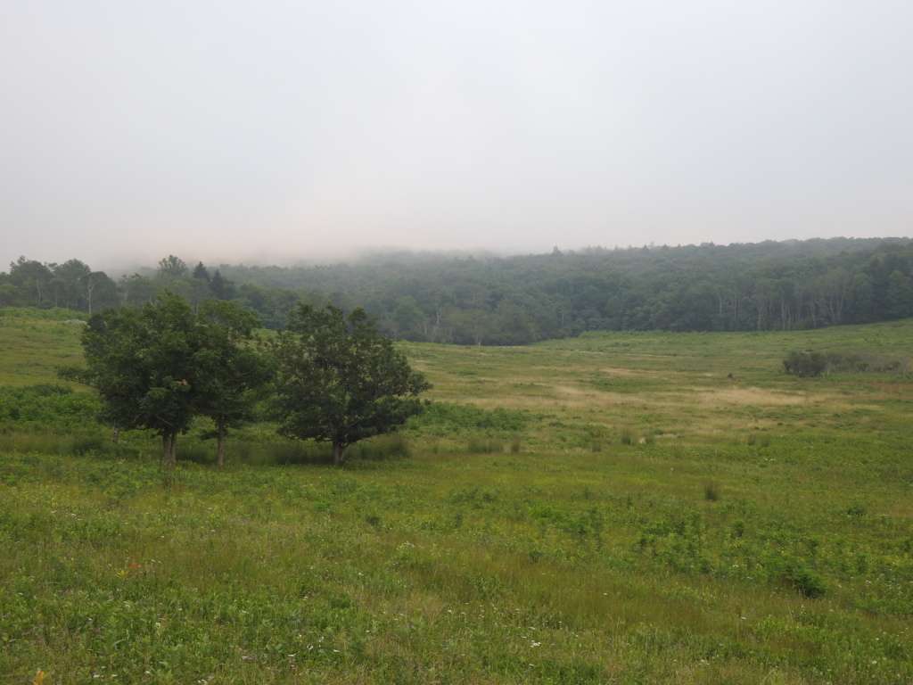
Skyline Drive is 105 miles long and has almost 70 overlooks. I checked out the major overlooks on the app and marked them as yes, no or maybe. The “yeses” we would stop at for sure and the “maybes” would be a judgement call based on time, mood, and location. Less than three miles into the park, the very first stop was the Shenandoah Valley Overlook, which looked out over (you guessed it!) the Shenandoah Valley.
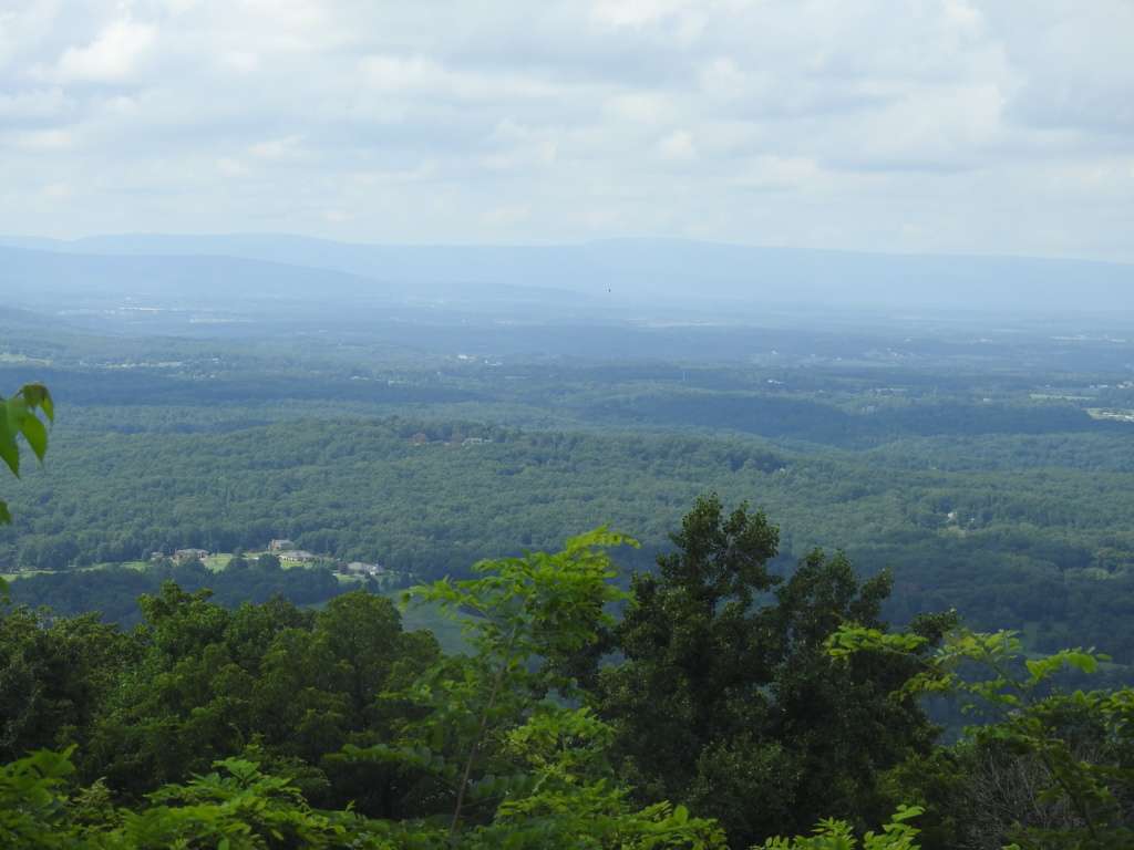
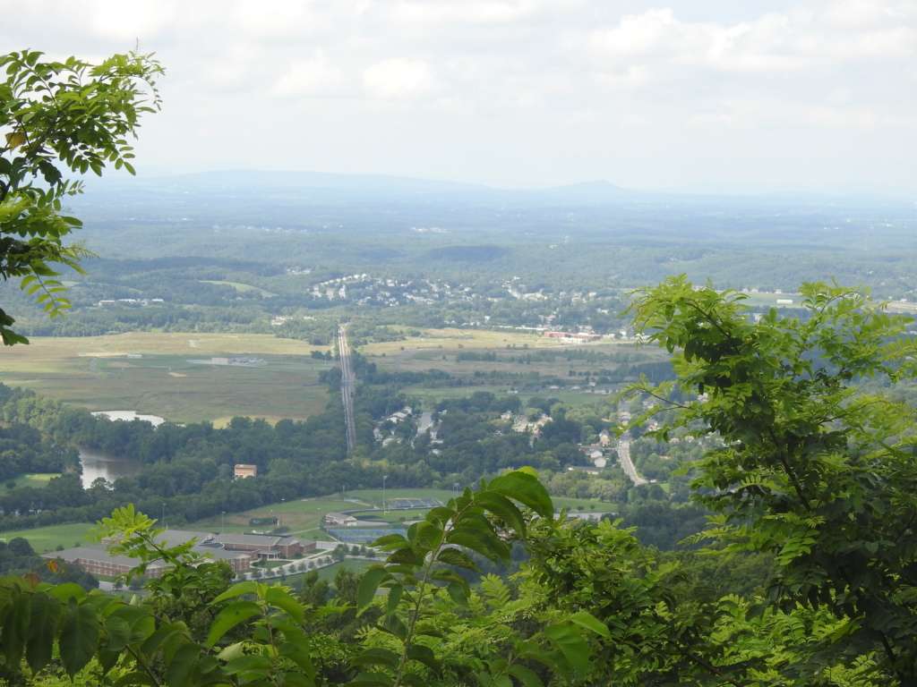
Again, I really recommend downloading the app before your visit. It was great for planning but awesome to use while in the park as well. There is information for every overlook – elevation, description, location, views. I loved knowing what we were actually looking at – the name of the mountains and valleys and towns in the distance. It added an extra element of interest to the experience to have such great information at our fingertips.
We did stop at the Dickey Ridge Visitors Center, although we knew it was closed due to Covid-19. But the bathrooms were open and the views were stunning.
Next up was the Signal Knob Overlook, between mile markers 5 and 6. Signal Knob is the northern most point of the Massanutten Mountain Range and was historically significant as a Confederate lookout point during the Civil War.
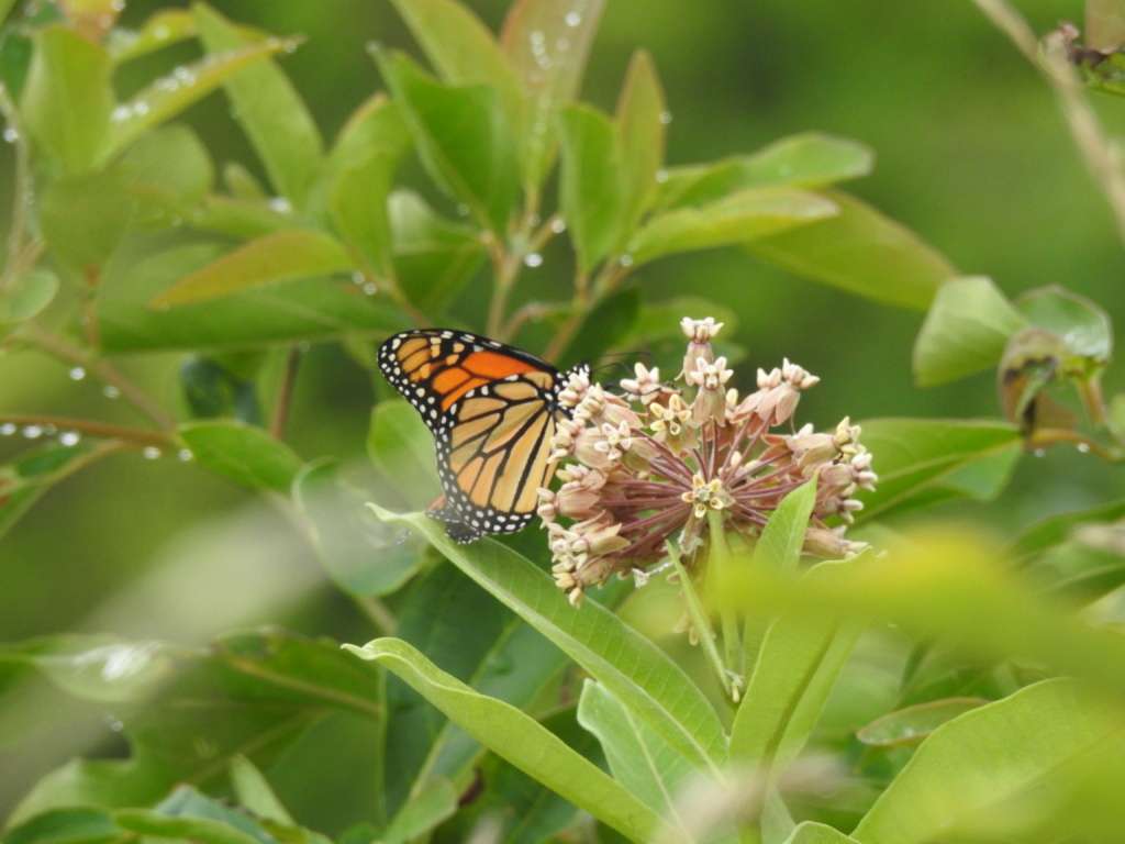
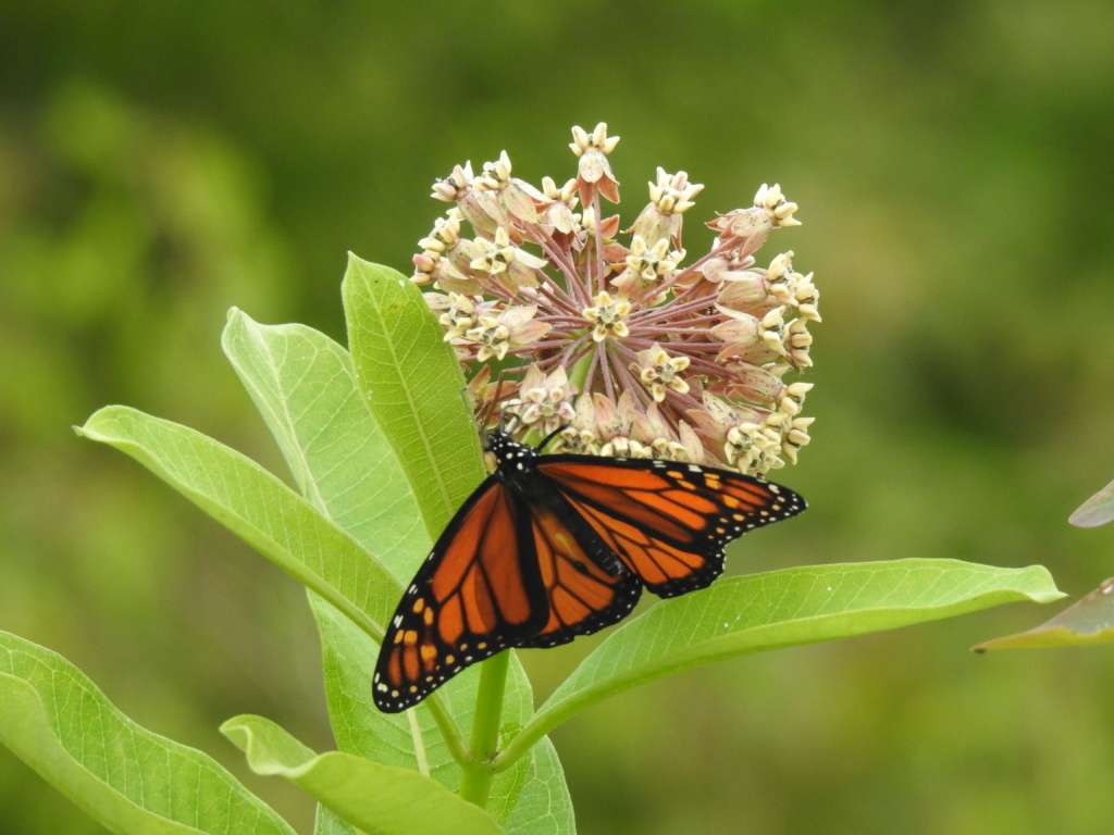
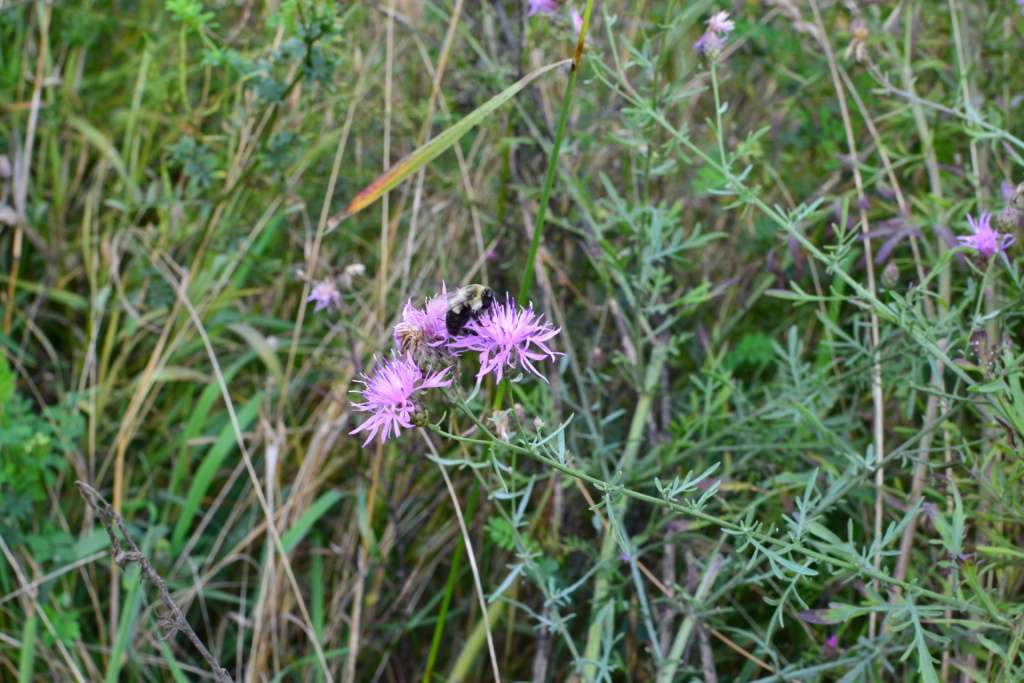
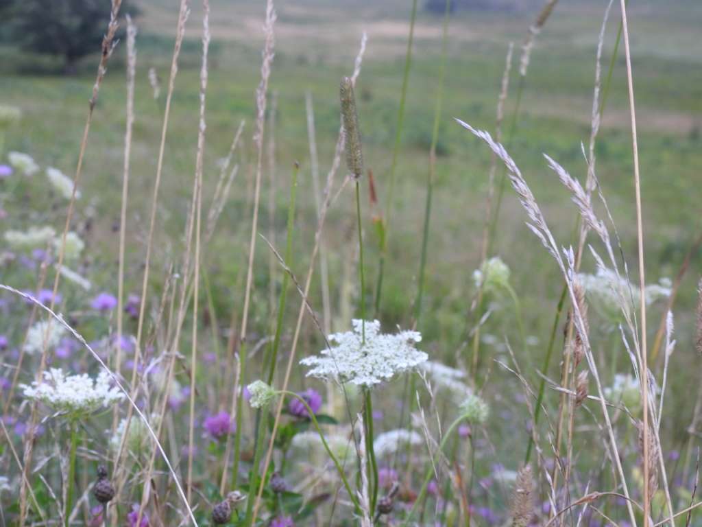
We loved all the wildflowers throughout the park. Not only were they beautiful to look at but they attracted tons of butterflies and bees. Butterflies were definitely the most abundant wildlife in the park at this time of year!
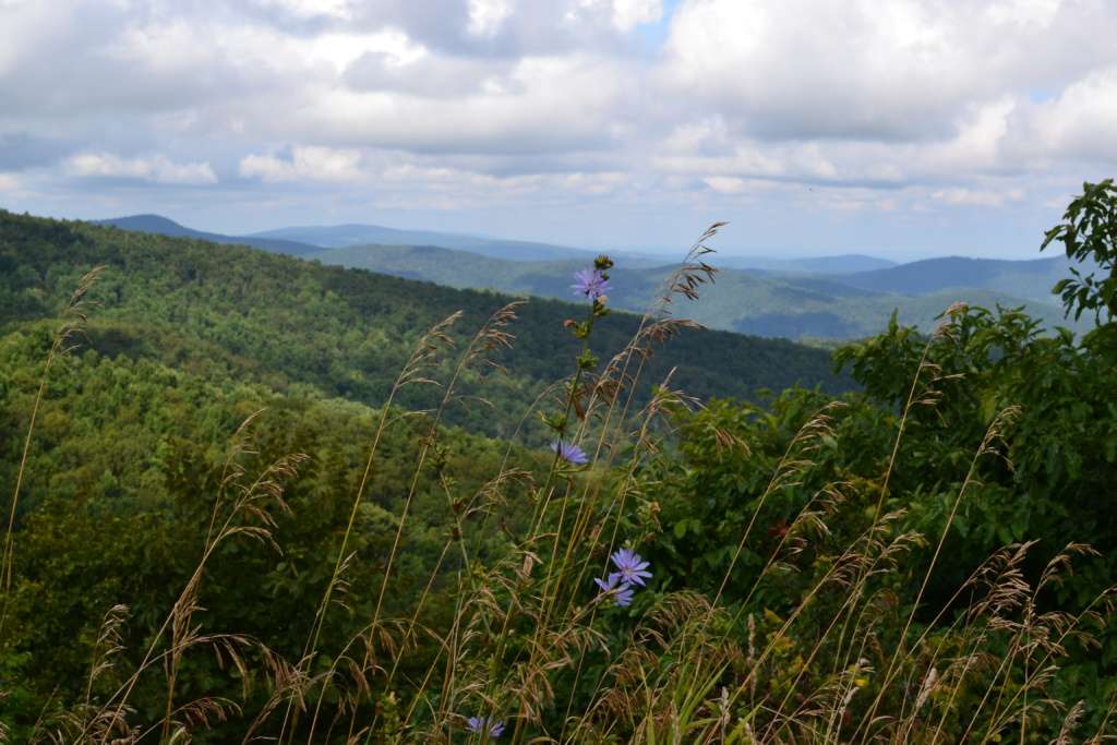
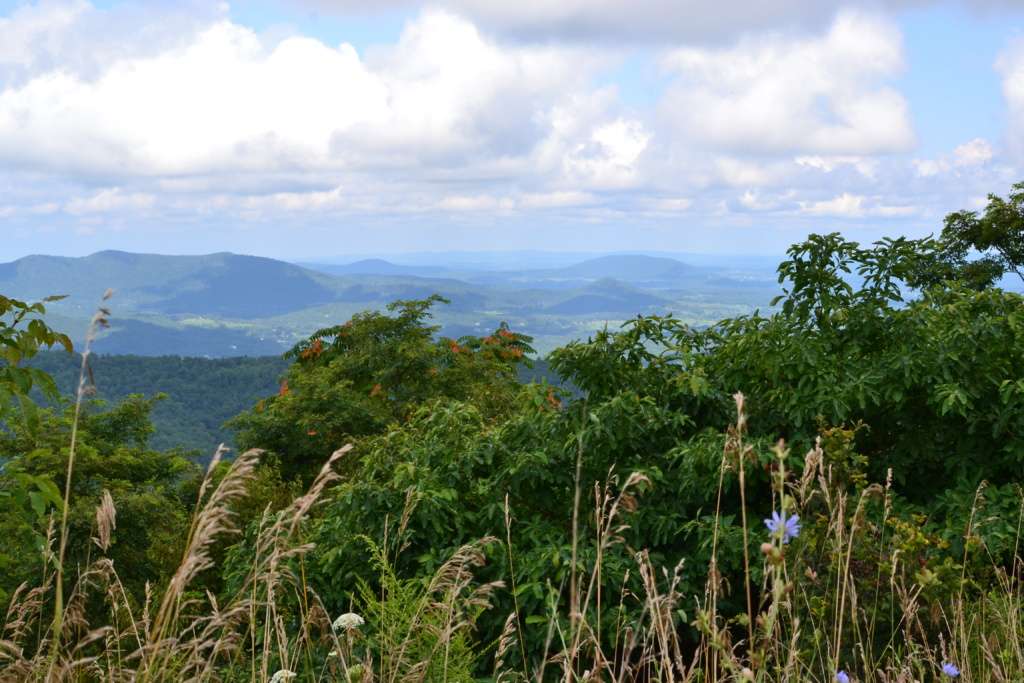
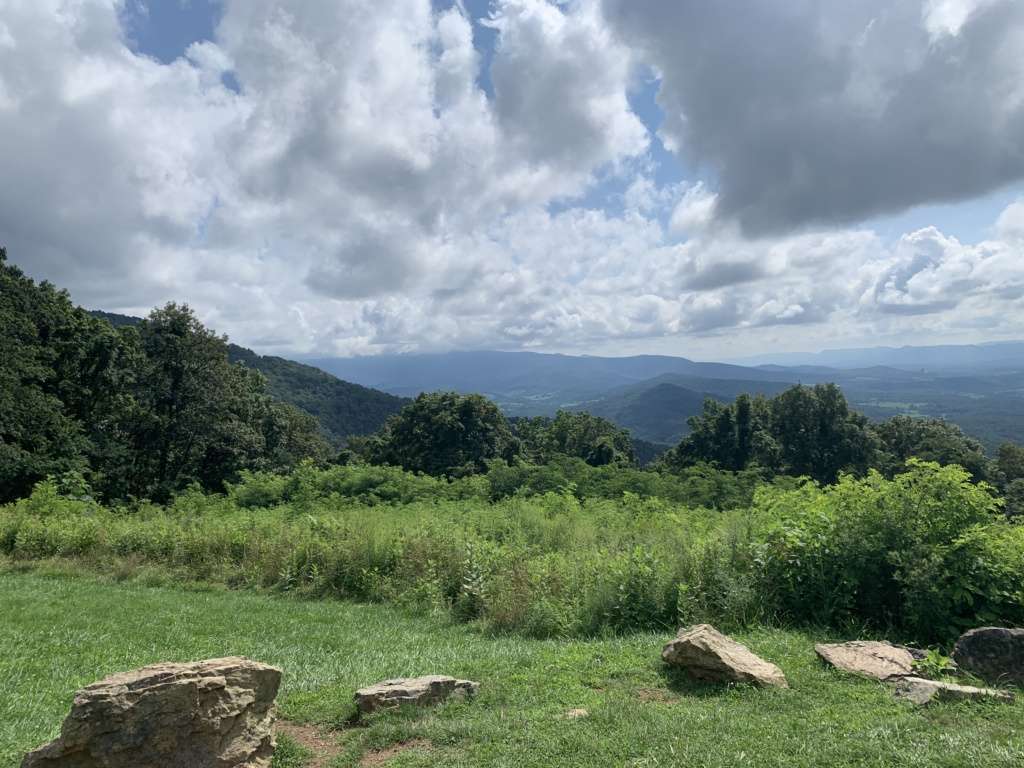
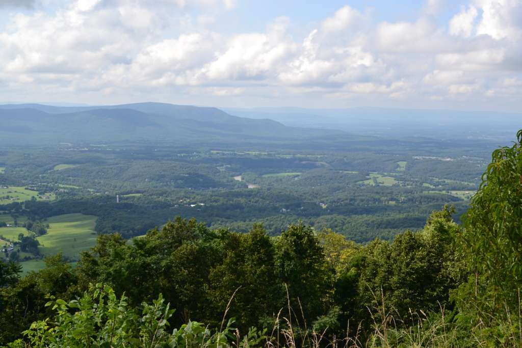
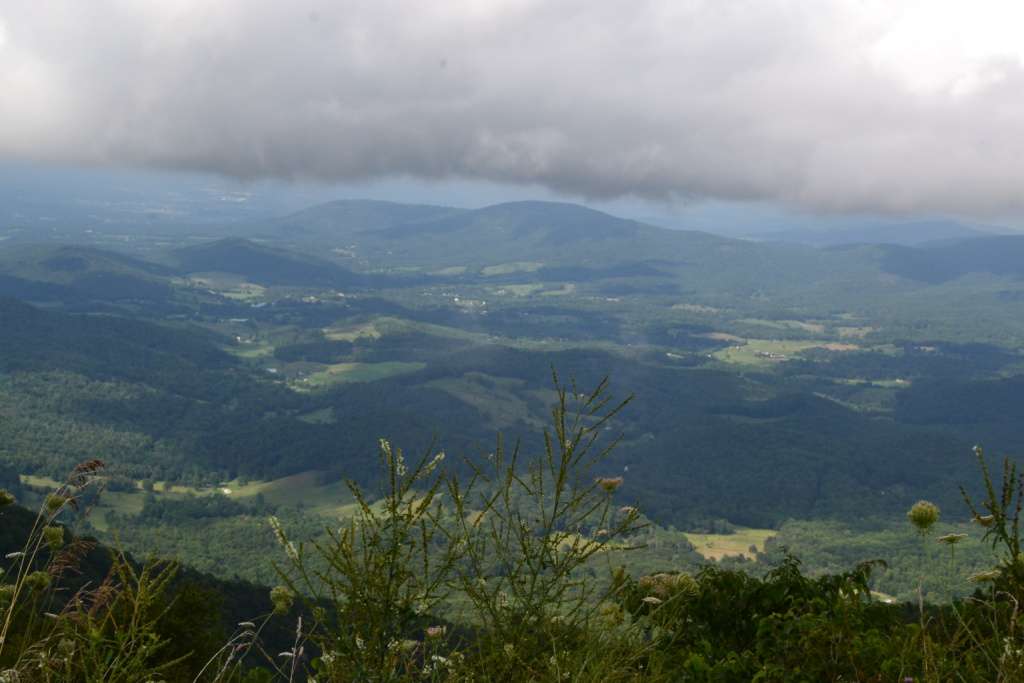
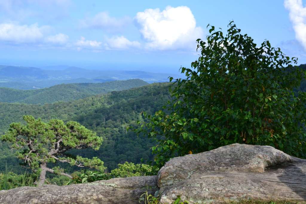
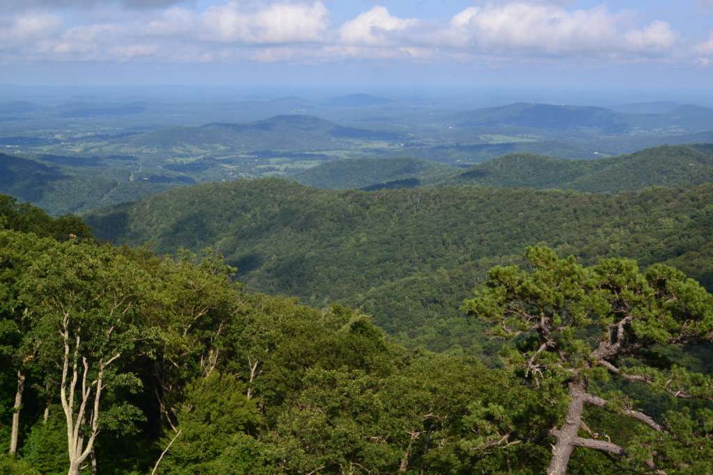
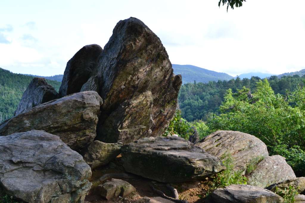
We stopped at Hogback Overlook, Thornton Hollow Overlook, Tunnel Parking Overlook, Hazel Mountain Overlook, and Spitler Knoll Overlook. Every view was stunning. The boys especially like Hazel Mountain Overlook, not only because it was named after our dog but because of the rocks they could climb on to get a better view.
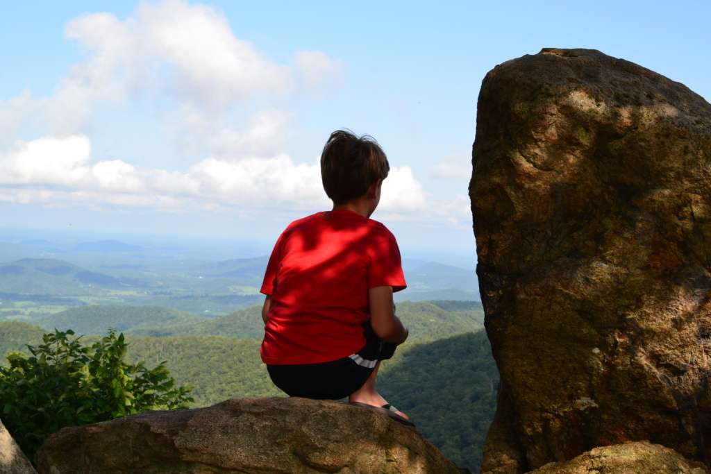
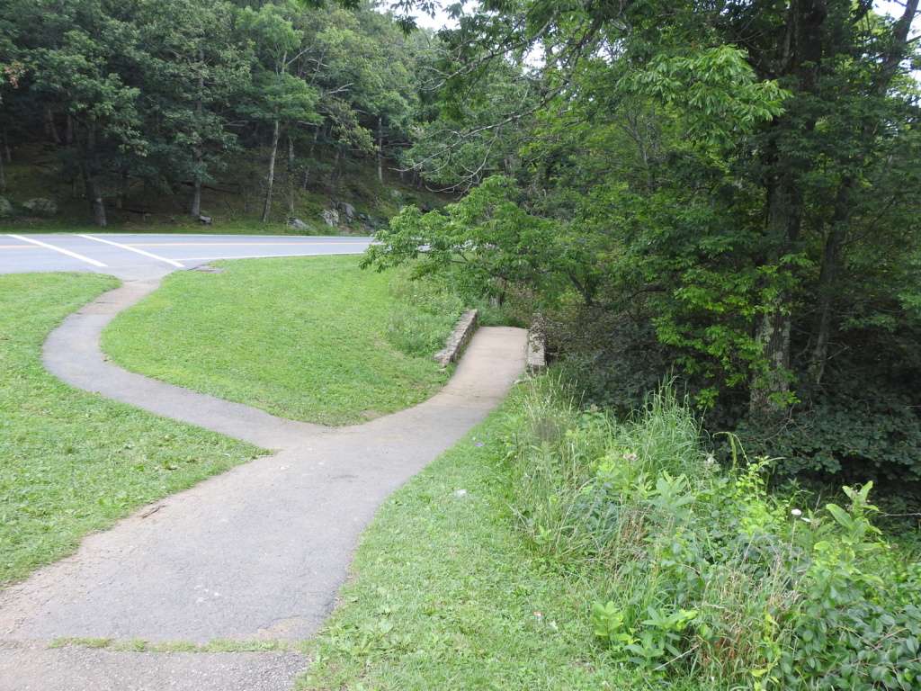
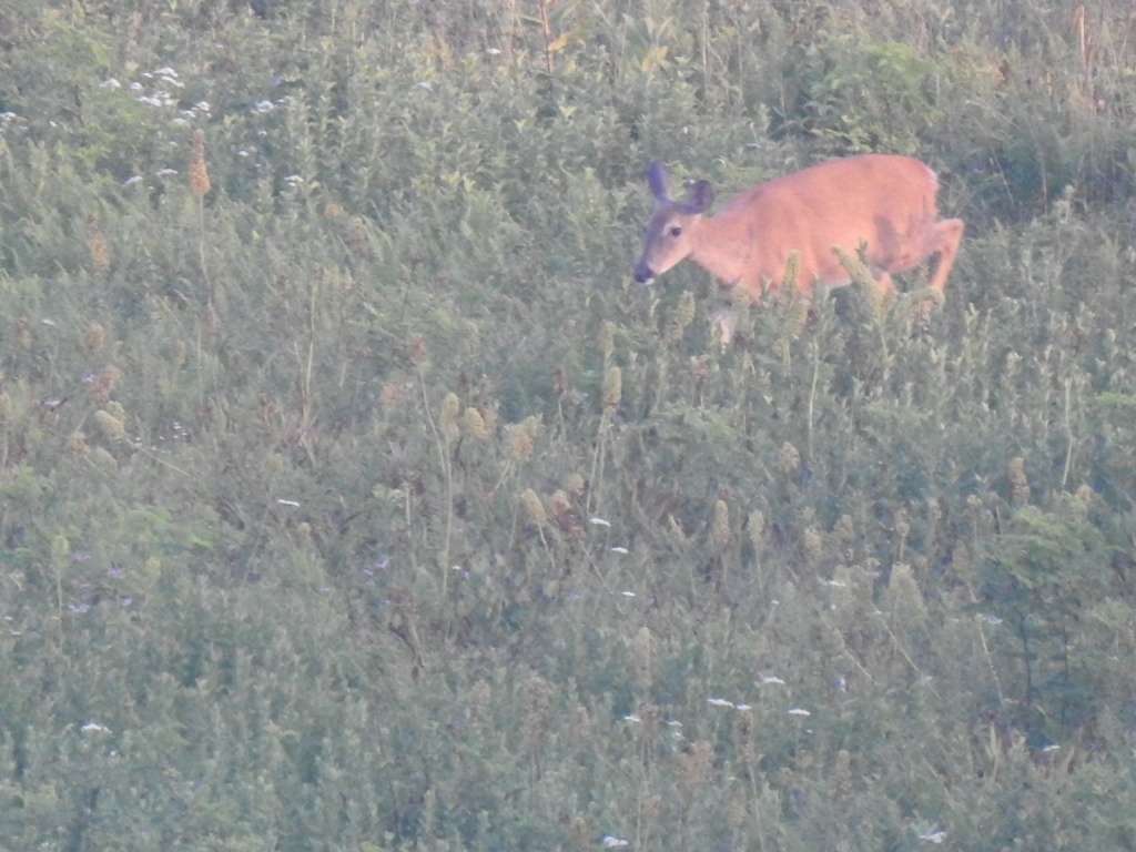
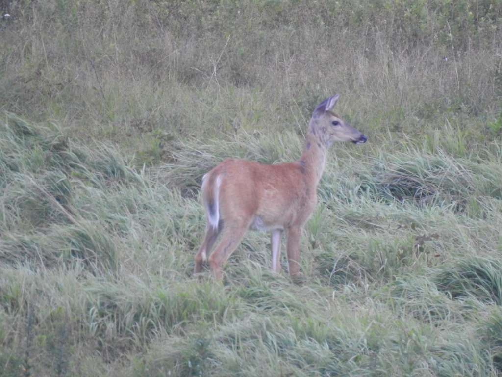
It was pushing 6:00 and we hadn’t even made it to our hike yet so we had to pick up the pace a bit. We had a bit of a hard time figuring out where the trailhead for Dark Hollows Trail was. We drove past it once and had to turn around at the Big Meadows visitor center. It was not a total waste of time though since we spotted our first deer there while we were turning around. My youngest especially had been hopeful for some wildlife spotting (especially bears!) and aside from insects, this was the first thing we saw. Such is the nature of wildlife! In any event, we did find the trail once we backtracked just a little bit.
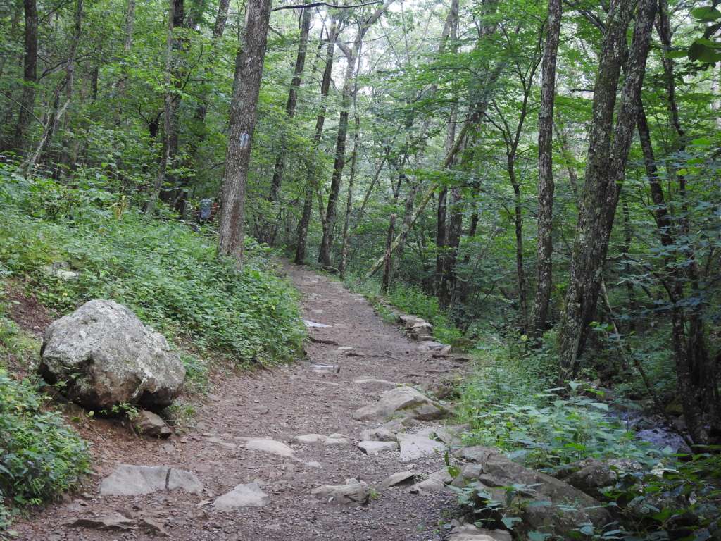
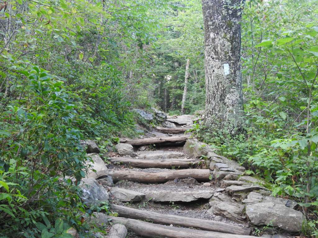
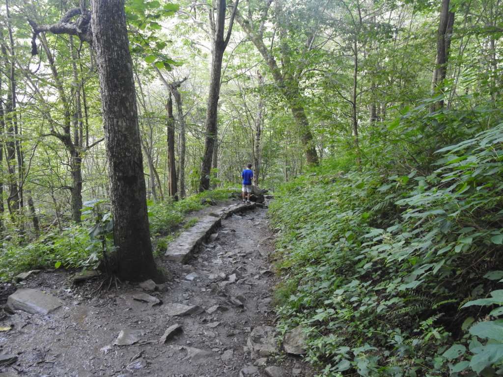
This trail was a little unique in that it was a hike down to the base of the waterfall, which meant that you had to hike back UP at the end. It was fairly steep in spots and ranked as a moderate trail. At 1.4 miles, we were able to compete the trail in about an hour and 20 minutes. There were a few younger kids on the trail and none of them seemed especially happy (or the parents carrying them on their shoulders were not happy). I would recommend this trail for about ages 8 and up.
My 10 year old, however, declared it “the greatest trail I’ve ever hiked”. He absolutely loved it. For most of the way, the trail ran alongside the creek that ultimately fed the waterfall. He loved that on the upper, flatter section of the trail he could walk along the creek, climb on the rocks, and wade in the stream. It was an off-trail adventure for him for most of the hike and that is the type of outdoor experience that he loves the most.
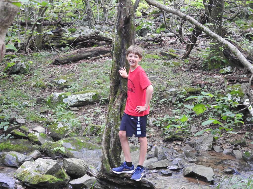
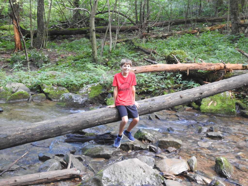
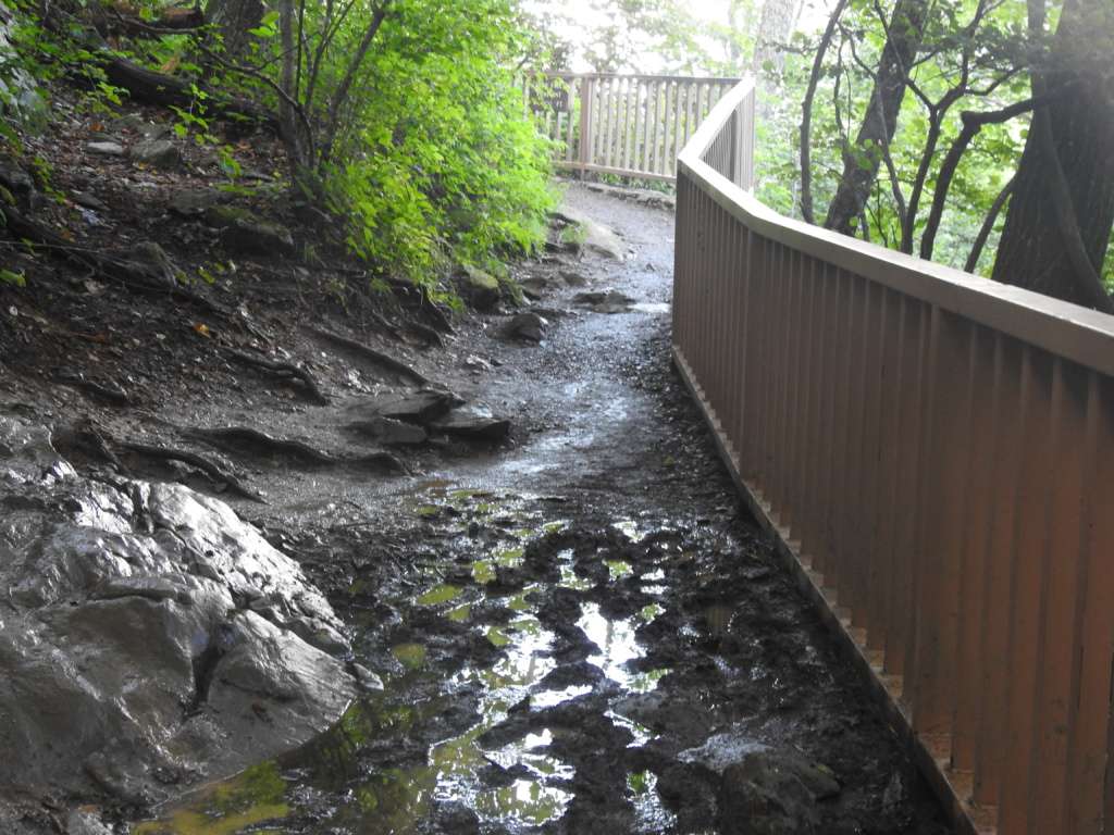
The trail is a combination of dirt/mud, rocks, tree roots and logs. It is definitely not stroller friendly (we saw one poor dad carrying a stroller and his kid on the way down) and is best for the sure-footed. It is a really fun hike though if you are up for a little bit of an adventure.
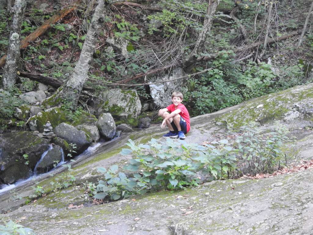
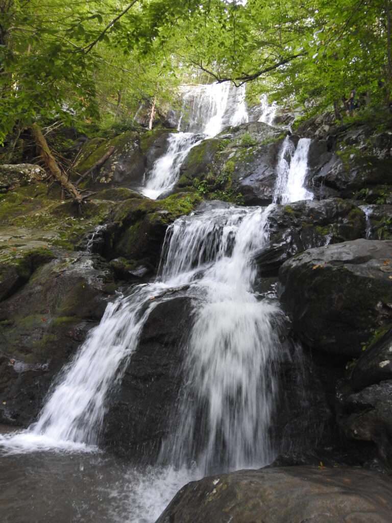
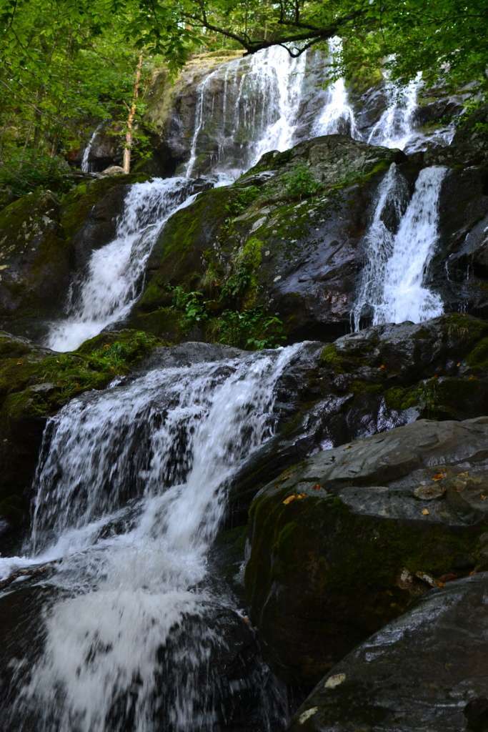
We made it down to the base of the waterfall in about 45 minutes. The falls are about 70 feet tall and the water falls in a series of cascades over mossy rocks to the base where the trail meets the falls. There are a few place where you can stand on the rocks here but the rocks can be slippery so be careful.
The trail actually continued on past the base of the falls. We walked a little bit and enjoyed the pretty views of the stream rushing by with several mini-falls along the rocks. Not many people walked past the base so it was quiet and peaceful on the trail here and we could hear the water trickle by in some spots and rush by in others.
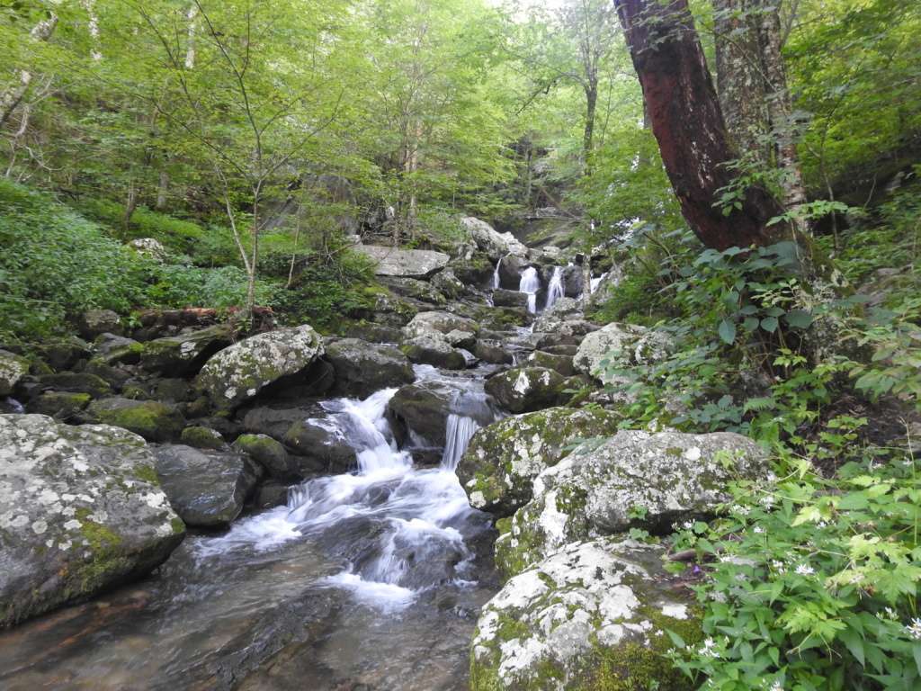
The Dark Hollow Falls Trail ultimately leads to the Rose River Fire Road and the much longer Rose River Loop Trail. While that trail will eventually lead you back to the parking lot, it is a 4 mile hike estimated to take 4.5 hours so make sure you know what you are getting yourself into. We did not have the time or the inclination for such a long hike so after getting our fill of the creek views, we headed back up.
The hike back up is definitely challenging, but we actually did it faster than the hike on the way down, mainly due to the fact that we took our time and explored on the way down and on the way up we basically walked straight out. This was a great hike that all of us enjoyed – it was challenging in parts but overall manageable, it was a beautiful wooded setting with a stream running alongside it, and it had an amazing waterfall at the end.
There are more than a dozen waterfalls accessible from trails in Shenandoah National Park but this one requires the shortest hike to reach it. As a result, it is probably one of the most crowded trails in the park. We definitely passed a lot of people on the trail (very few wearing masks, which was expected outdoors) and we had to wait our turn to get out on the rocks at the base in order to keep our distance from people. We were there towards the end of the day and it was definitely less crowded on the way out than it had been on the way in.
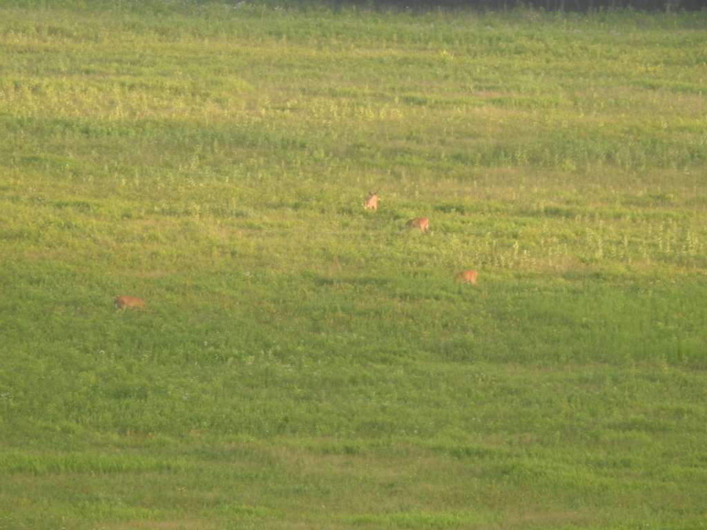
It was past dinner time and the sun was getting close to setting, so we were ready to wrap up our Shenandoah National Park adventure. We stopped at the Byrd Visitor Center to use the bathrooms before hitting the road and noticed tons of people across the street in Big Meadows. Big Meadows is exactly as it sounds – a big meadow. It is full of grasses and wildflowers and berries and attracts tons of wildlife, especially at dawn and dusk. All the people we saw were staking out a spot to watch the wildlife emerge for their evening feeding. Although we didn’t set up for long-term viewing, we did walk across the street and enjoy watching the deer from afar.
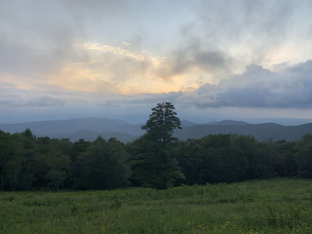
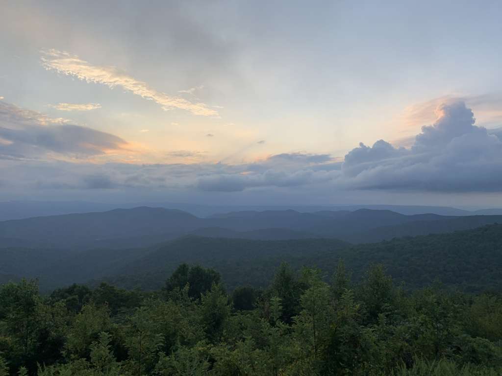
It was getting close to 8:00 and we still had to drive to our hotel in Harrisonburg so we continued along Skyline Drive to the Swift Run Gap Entrance. But I couldn’t resist pulling over at two or three different overlooks to catch a glimpse of the stunning sunset over mountains. It was simply gorgeous.
Overall, our Shenandoah National Park experience spanned 5 hours, 65 scenic miles, 12 overlooks, 1 (1.5 mile) hike, and 1 waterfall. That’s a lot to pack in for such a short visit! We were blown away by the views and would love to go back for a longer stay. I had considered staying in the park itself instead of Harrisonburg, but we were a little leery of our first hotel stay during Covid-19 and the lodges in the parks weren’t getting great reviews in that area. But when travel returns a bit more towards normal, I would love to go back and spend a night or two in the park. I think it has so much to offer and we only brushed the surface.