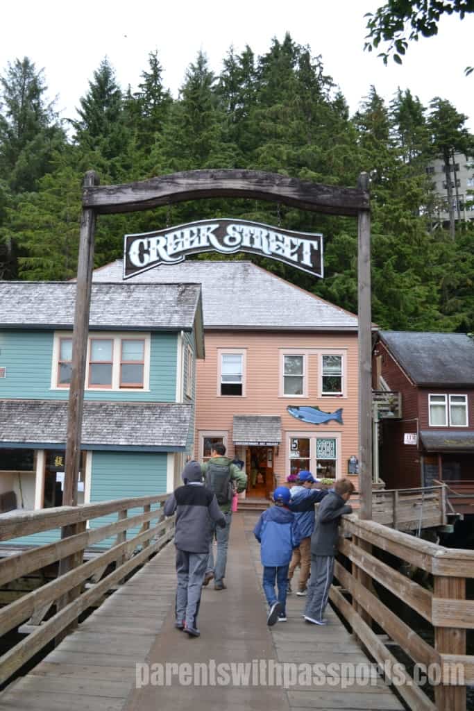
Like all of our tours, our guide gave us the option of being dropped off in town or taken back to the port. Again, our larger family group split up, with some going back to the ship and some exploring the town. We definitely wanted to see Creek Street so we opted to be dropped off in town.
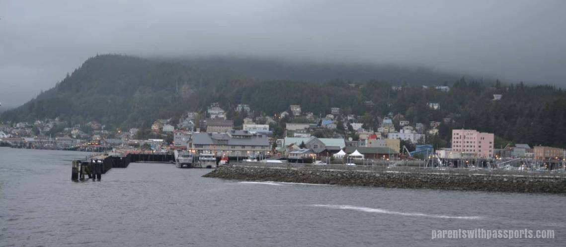
Ketchikan is the southernmost city in Alaska’s Inside Passage. The town has its roots in fishing. First Native Americans used it as a fishing settlement, and later a salmon cannery was built to provide supplies to miners during the 1890s gold rush. Fishing continues to be an important part of their economy, as does logging and tourism.
Ketchikan is located in the Tongass National Forest, North America’s northernmost temperate rainforest and the United States’ largest national forest. The average annual rainfall is 162 inches so we were prepared for the clouds and occasional rain that we experienced on our stop. The 300 days a year of rain doesn’t seem to bother locals – they call it “liquid sunshine”.
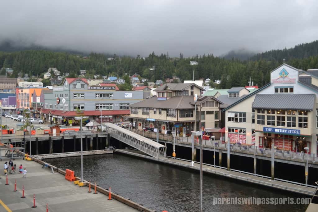
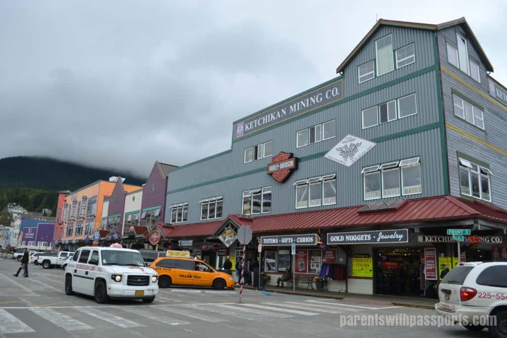
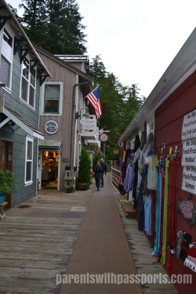
The town itself comes right up to the cruise ship docks. Souvenir shops line the streets. You will find both locally owned shops selling authentic Alaskan Native art and mass-marketed tourist stores. We loved browsing the smaller local shops and enjoyed seeing the works of local craftsmen and artists.
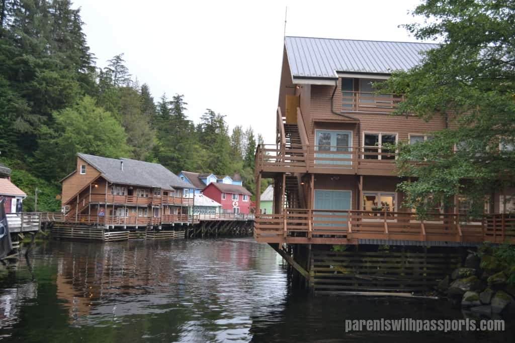
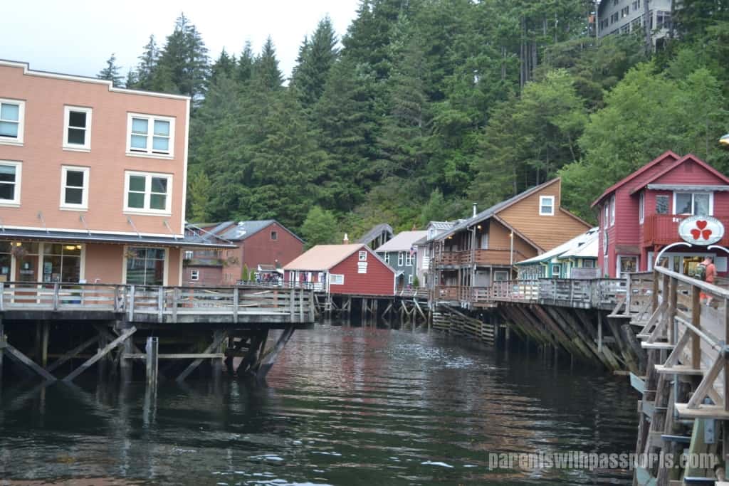
Creek Street is the main attraction in the town itself. Creek Street is not your typical street. The “street” is a boardwalk built on wooden pilings over Ketchikan Creek, with buildings on stilts lining its far side. Built in the 1920s as the town’s red-light district, there were some 20 brothels on the west bank of the creek, built over the water and in to the tricky mountain terrain in order to circumvent the city ordinance banning brothels on the east side of the creek. Later during prohibition, some of the brothels became speakeasies, and rowboats crept in under the dark of night to deliver alcohol through trap doors in the floors. Today the buildings are a mix of shops, restaurants, and museums.
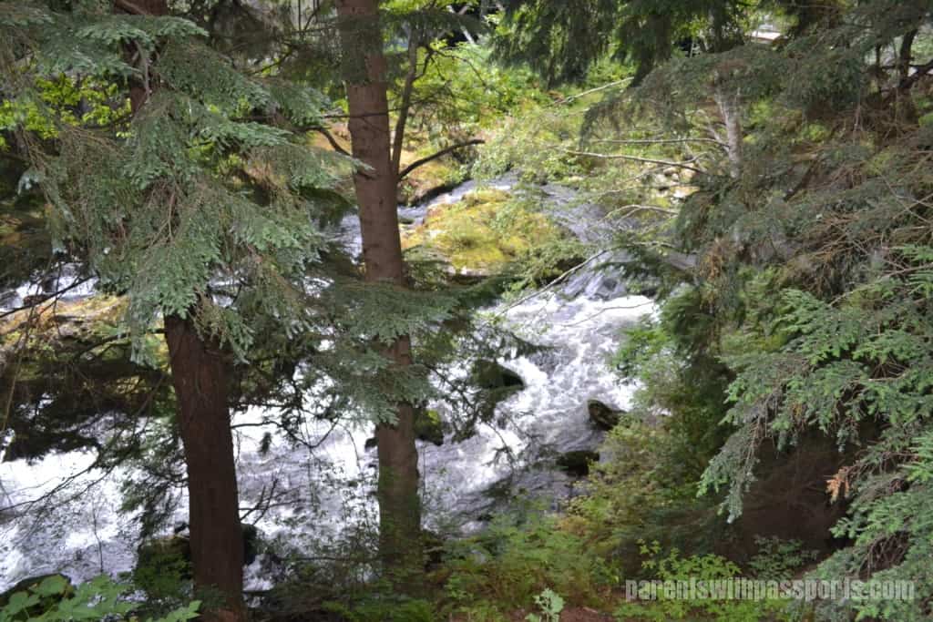
After wandering down creek street and peeking into some shops, we headed back up the creek to see the salmon ladder. Past the buildings, the creek waters started to rush faster. We could see and hear the white water ahead.
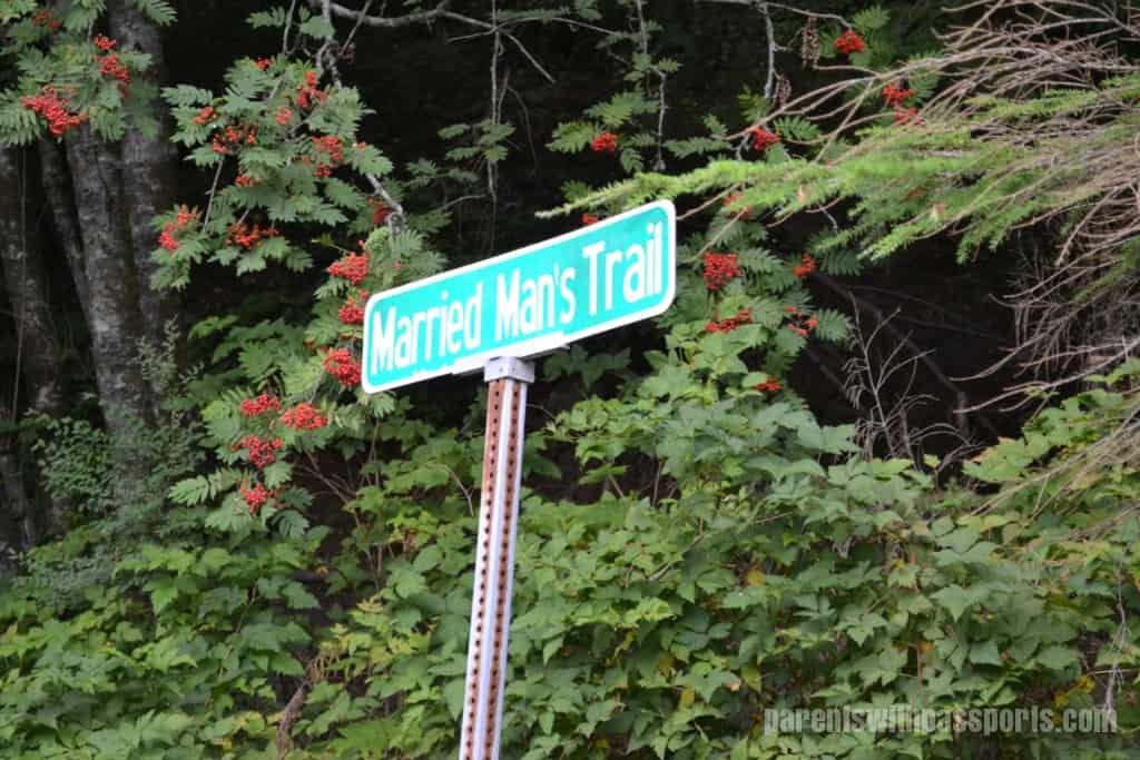
As we followed the creek upstream, we came to a sign for “Married Man’s Trail.” Apparently once upon a time this was the discreet path to the brothels on Creek Street (and also the escape route during police raids).
We were using the trail for a much more innocent reason – to visit the salmon ladder. I’ll admit that I didn’t know what a fish ladder was, and I was curious to see it. As we made our way to the top of the trail, we could hear the water roaring below us. When we got to the street that crosses over the creek, I was stunned at how rapid the waters were.
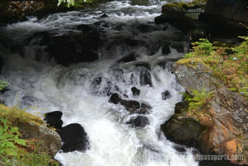
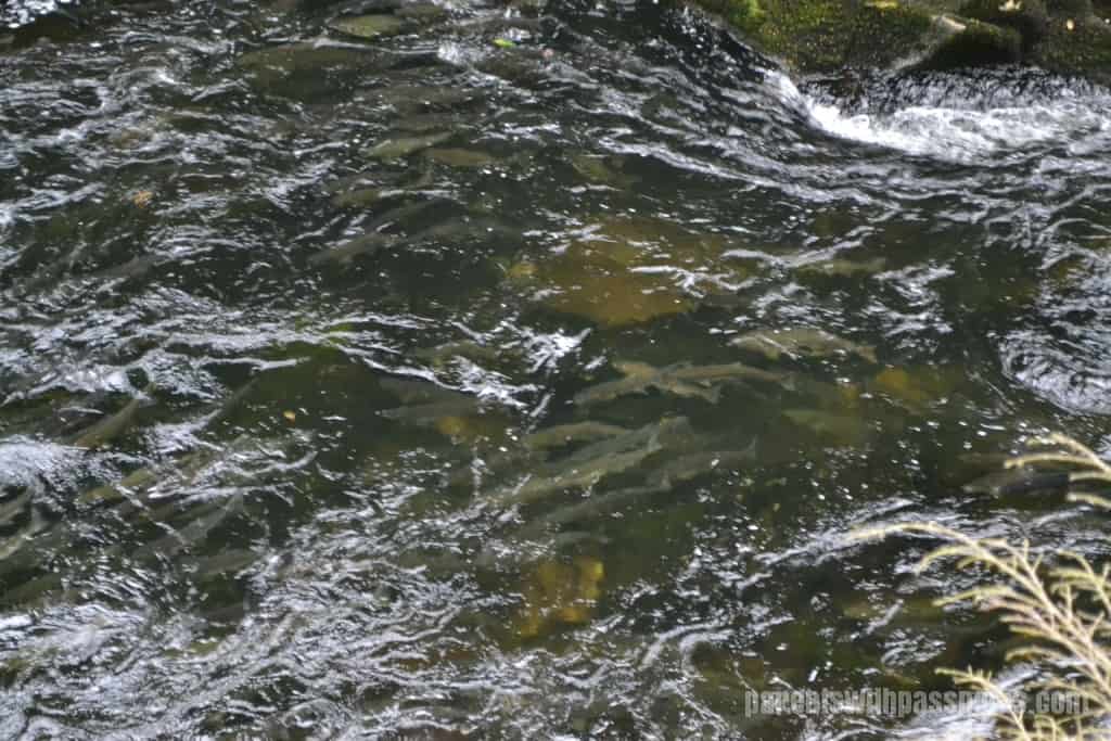
It was unbelievable to me that fish swam UP this water. Salmon are born in freshwater streams and then migrate to the ocean. During the “salmon run”, the salmon return to the exact spot where they were born to lay their own eggs. The catch is that they have to swim upstream to get back there. They swim hard and jump out of the water in an effort to continue moving up the rapids.
It was truly an amazing sight to see. There were thousands of them in the creek, fighting their way up the waterfall. It’s nearly impossible to photograph underwater fish from above, but if you look closely in the center of the picture below, you can make out dozens of salmon swimming upstream.
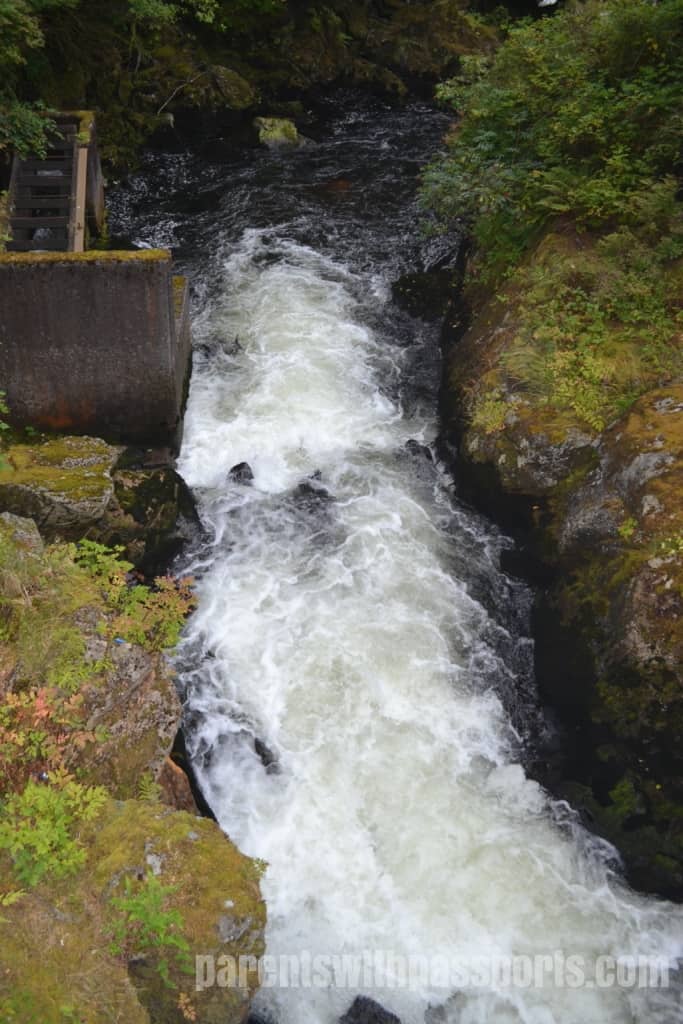
In extreme cases like this rushing waterfall, humans often intervene by building fish ladders. Fish ladders give salmon an alternate, somewhat calmer route upstream. To use the ladder, the salmon must leap up a series of low steps. The ladder is off to the side and has a slower stream of water, making it easier for the fish to make it to the top. This was a fascinating idea to me, but we didn’t see a single fish choose this alternate route. We watched them jumping up out of the whitewater, trying to make it on their own.
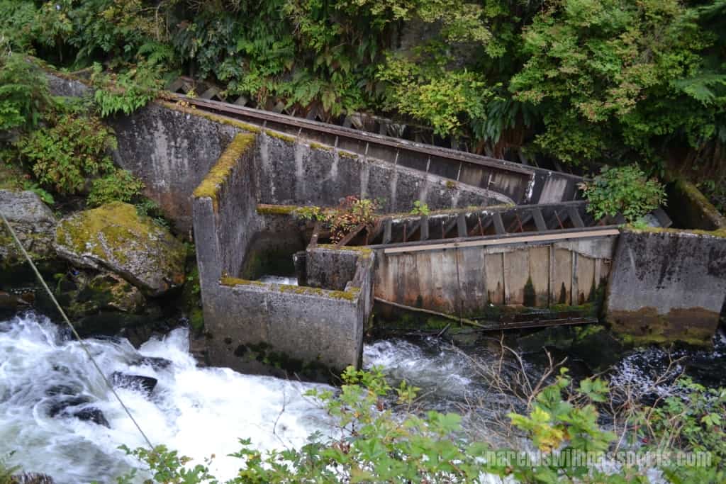
This was a really neat experience for all of us. You really can’t wrap your head around the whole process until you see it yourself in person. The sheer force of the water was only exceeded by the salmon’s will to get through it. It was truly impressive.
After Creek Street and the salmon ladder, we just made our way back through town, stopping in shops along the way. We thought Ketchikan was a unique place and fun to walk around.
Some Ketchikan fun facts:
- Ketchikan calls itself “Alaska’s 1st City”, not because it was incorporated first but because it is the first city as you travel north up the Inside Passage.
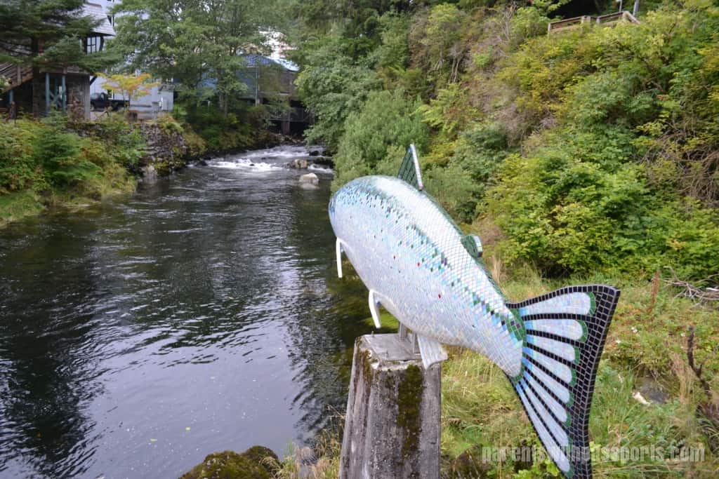
- Ketchikan is also known as the Salmon Capital of the World.
- Ketchikan is located on an island (Revillagigedo Island).
- The name Ketchikan comes from the Tlingit word “kitschk-hin”, meaning creek.
- Ketchikan’s first fish cannery opened in 1886. 50 years later there were 7 canneries producing 1.5 million cases of salmon each year.
- Creek Street was built as a red-light district in the early 1900s.
- Ketchikan is surrounded by Tongass National Forest which, at 17 million acres, is the largest forest in the US.
- Ketchikan averages 162 inches of rain a year.
- Ketchikan has the world’s largest collection of totem poles.