We booked the “Yukon Rail & Bus Excursion with Dogcart Experience” with Chilkoot Charters & Tours for our Skagway port day. (Read my full review of the tour company here.) We opted for the “bus first” tour, which started later and would frontload the more active part of the trip, allowing the kids to rest on the train ride home.
We met our (surprisingly Irish) tour guide Anne at the end of the cruise ship dock and boarded the bus. Driving out of Skagway, she gave us a brief history of the town. We learned about the masses of people who gathered in the town during the goldrush and the lawlessness that followed. Serial swindler “Soapy” Smith (so nicknamed because of a “prize soap” con that he ran successfully for some 20 years) moved to Skagway in 1897 and became head of the town’s criminal element until he was killed in a gunfight stemming from a dispute over winnings in an illegal card game. The town certainly had a sordid and colorful past.
The weather was cloudy and cold as we headed out of town. Our tour guide Anne assured us that the weather would clear but we were doubtful. As I was pondering the weather and its impact on our scenic journey, I noticed a van in front of us slowing down and pulling over. I looked to the side of the road and spotted what made them stop… a black bear!
We pulled over too and watched the big bear amble along the side of the road for a while before walking up into the woods off the side of the road. We were so excited!!! Bears can be a little elusive in Alaska – often your best chance at spotting them is on a bear viewing tour that comes with a helicopter and a high price tag. Short of doing that, I thought our best chance of seeing them would be at the creek in Ketchikan where the salmon were running so seeing one unexpectedly at our first port was such an amazing surprise.
With everyone still bubbling over our bear spotting, we continued on. We had a long journey ahead of us with a lot of stops. I was increasingly skeptical about the weather clearing since it was actually getting significantly foggier as we climbed the mountain. But Anne kept telling us not to worry and that the fog would lift.
Traveling up the Klondike Highway, we pulled over at a scenic overlook for our first stop, Brackett Wagon Road. During the gold rush, the trails that the prospectors took by foot into Yukon territory were treacherous. Conditions were so terrible along the trails that only 30,000 of the 100,000 prospectors completed the trip.
In order to provide a safer alternative (and, of course, to make money), businessman and former Minneapolis mayor George Brackett built a toll wagon road connecting Skagway to White Pass City. The road took less than 6 months to build and was completed in May 1898. Unfortunately for him, the White Pass & Yukon Route Railroad opened up shortly after along the same route. Facing financial ruin, Brackett sold the toll road to the railroad for $110,000.
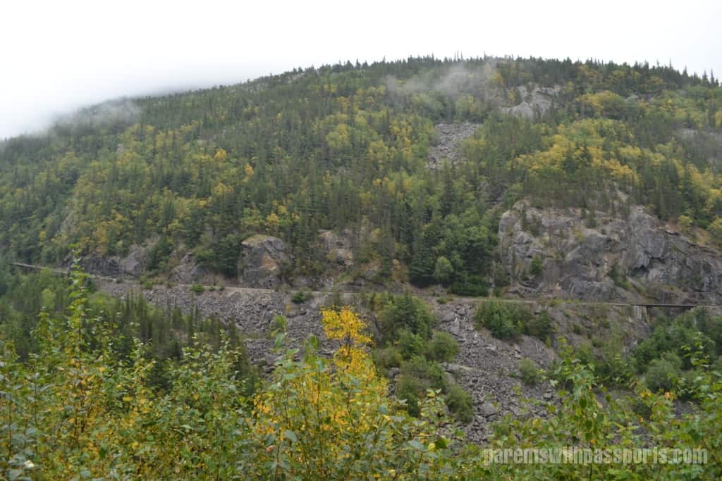
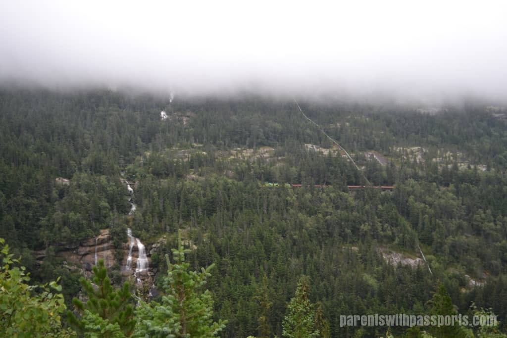
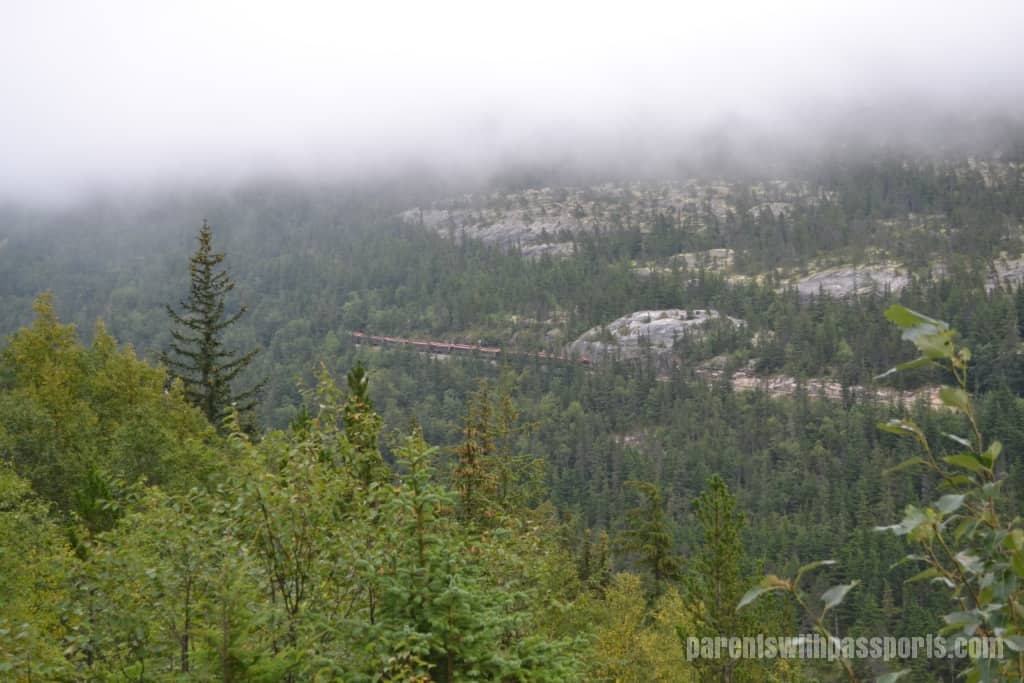
From the overlook we could see the train tracks built along the side of the rocky cliffs, and we caught our first glimpse of the White Pass train going by. Rickety wooden bridges crossed over gaps that opened to the valley below. The toll road ran below the tracks along the valley, although there isn’t much remaining of it today. But from the overlook you can still make out fragmented sections of the road.
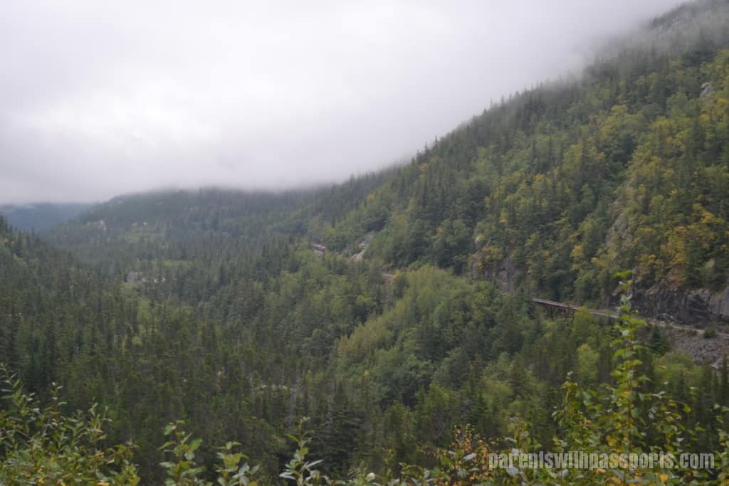
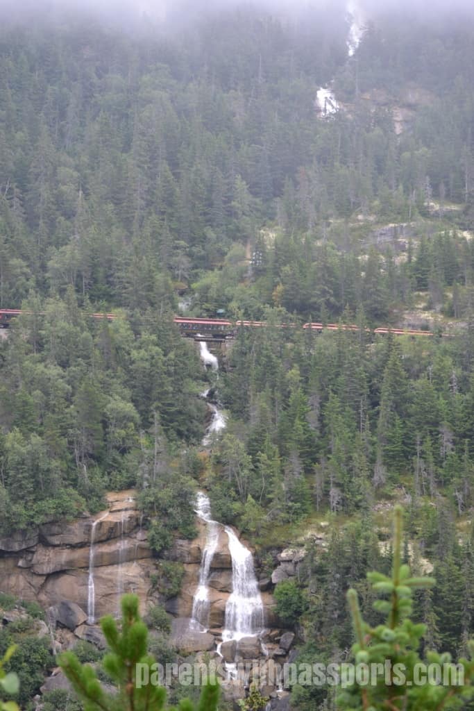
We returned to the bus and headed a little further up the road. About 2 miles later, we pulled off at another overlook. This time we had a great view of Pitchfork Falls. We got there just in time to see the White Pass train cross in front of the falls.
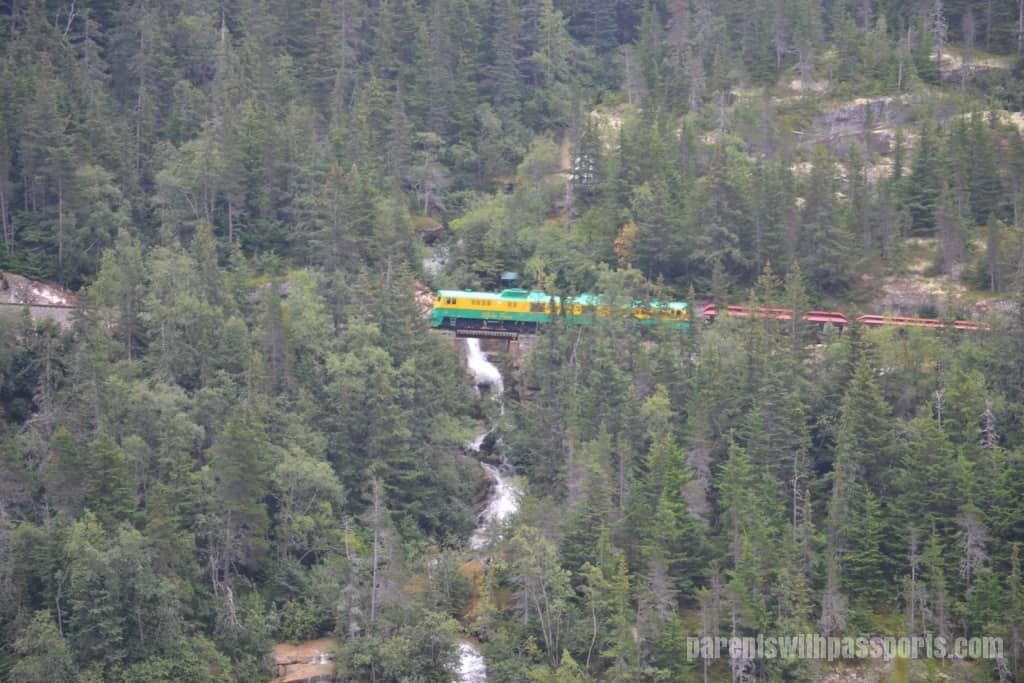
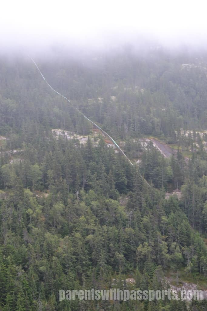
Pitchfork Falls is 2,100 feet tall, placing it among the tallest waterfalls in the world. The water flows from glacier-fed Goat Lake at the top of the mountain down to the Skagway River below. Running parallel to the waterfall on the right is a pipeline that is part of the Goat Lake Hydroelectric Project. The pipe carries water from the lake to a hydroelectric power plant below the highway, which is used to provide power to Skagway and Haines. (Note the heavy fog still hanging in the air.)
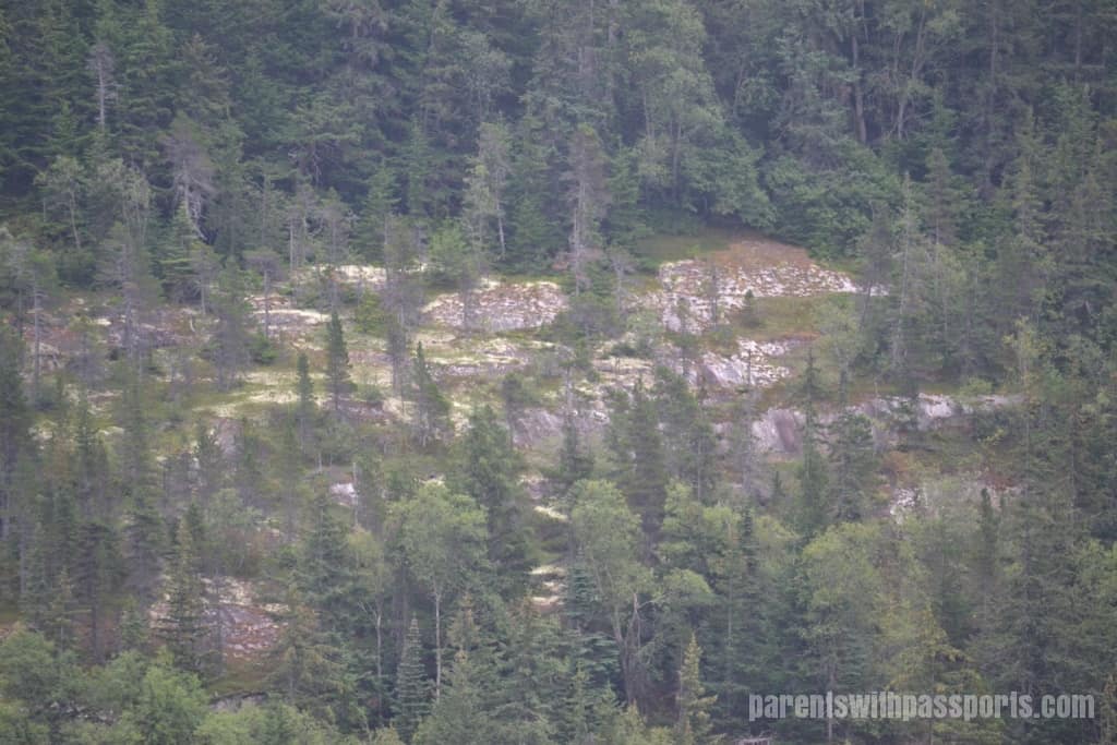
At this point along the Klondike Highway, we saw our first signs of a change in landscape. While the terrain was still dominated by trees, there were patches of rock with yellow lichen. We would see a lot more of this as we continued our drive and crossed into the subarctic ecosystem.
The fog seemed to grow thicker as we went higher, although there was one point in the trip where I was ok with the fact that the fog blocked our view. We had to cross over a 110 foot wide gorge with a 180 foot drop to the creek below. That in itself might not be too bad under normal circumstances but we learned before we crossed over the William Moore Bridge that we were going over a very active earthquake fault line. In order to allow the cable-stayed suspension bridge to move freely in the event of an earthquake, it is only anchored on one side. Yikes!
About 10 miles later we crossed into Canada. We had to stop at the Canada Customs post, where an officer boarded the bus to check our passports. It was a quick process; we simply opened our passports to the picture and held them next to our face as he walked down the bus aisle to inspect them. Note that everyone will need a passport to enter Canada, and the kids were warned not to joke around while the officer was on the bus. There is actually a time zone change when you cross into Canada, but to keep things simple for the tour, we were told to remain on US time.
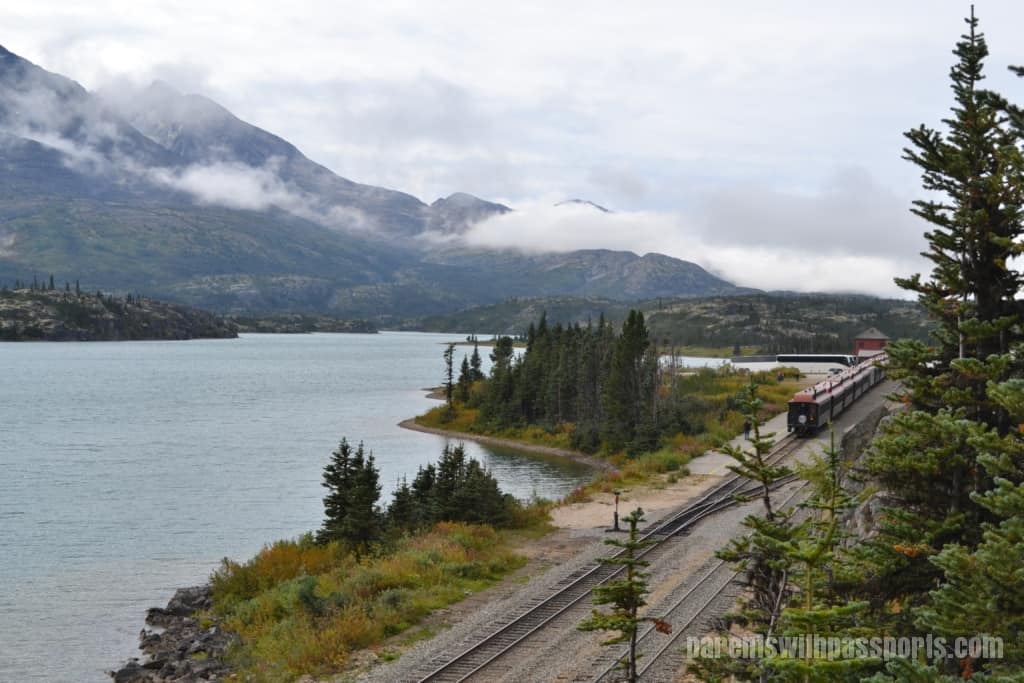
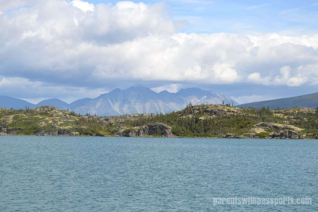
Just on the other side of the US – Canada border, we stopped at a lookout over Bernard Lake in Fraser, British Columbia. Fraser is a fascinating place – it has no permanent residents or businesses. The settlement exists solely to support the customs employees and highway maintenance workers.
We had been a few minutes ahead of the train at all our stops and it caught up to us here again. Fraser is a station for the White Pass & Yukon Route and we would board the train here later for our return trip to Skagway.
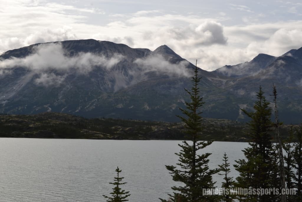
We stayed for a few minutes to enjoy the view. The fog was finally lifting, just as Anne had promised. We saw peeks of blue sky and more and more signs of the subarctic tundra we were heading in to. The trees were starting to thin out (both in number and in branches), as more rocks and lichen dominated the landscape. Fraser gets an average of 24 feet of snow a year, and its alpine firs have withstood being half buried in snow and half exposed to icy winds for decades.
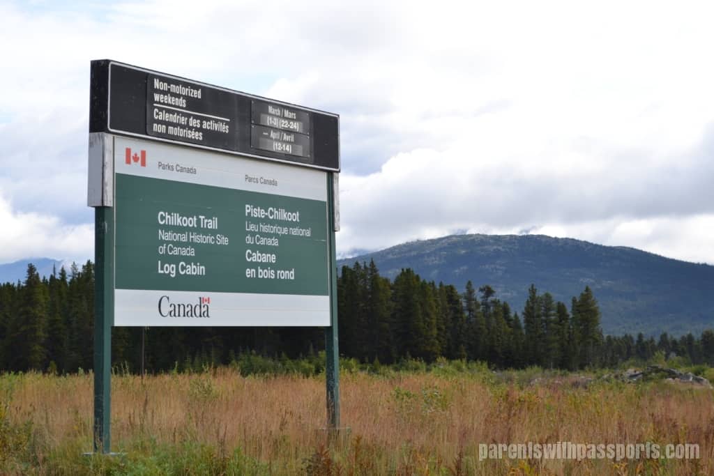
When we left Fraser, Anne told us our next stop would be Log Cabin and it would be our last chance for a bathroom break for a while. Log Cabin was a transitory gold rush community, where those traveling on the White Pass trail from Skagway could rest. Today it is an exit point for Chilkoot Trail hikers and a rest area along the Klondike Highway, as well as the spot where the highway crosses the railroad tracks. It is also quite possibly the most disgusting bathroom we have ever seen (or at least smelled). The “bathrooms” amounted to outhouse toilets that were basically just a hole in the ground. Most people left gagging and many changed their mind and didn’t go in at all. I decided I didn’t need to go and the boys found some better smelling trees to use instead.
But as bad as the bathrooms were, the view was amazing. There are not a lot of highway rest areas in the world with scenery like this.
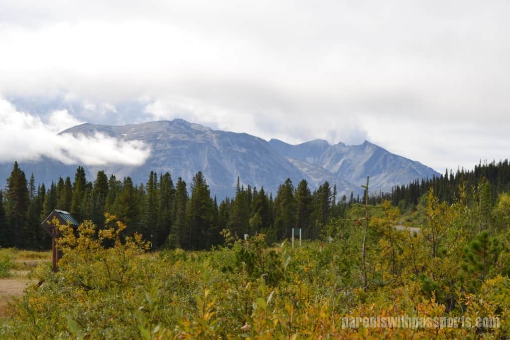
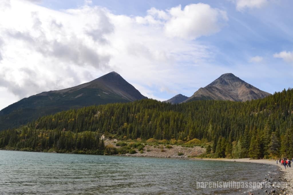
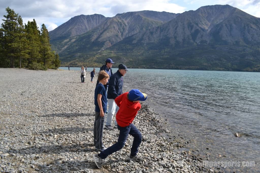
After our break at Log Cabin, we continued up the road to Tutshi Lake (pronounced too-shy). We had a nice stop here. Again, the scenery was stunning, and the kids loved skipping stones into the lake. And Anne was right… although there were still clouds in the sky, the fog had lifted and it was turning into a beautiful day.
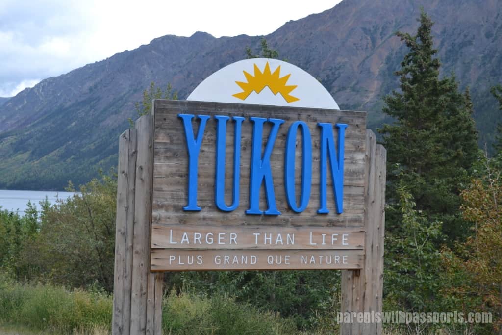
Our final stop before reaching Caribou Crossing was the Yukon sign. A large sign declaring the Yukon as “Larger than Life” greets you as you cross from British Columbia into the Yukon. (Sadly, we were running late for the train and missed the welcome to Alaska sign on the way back.)
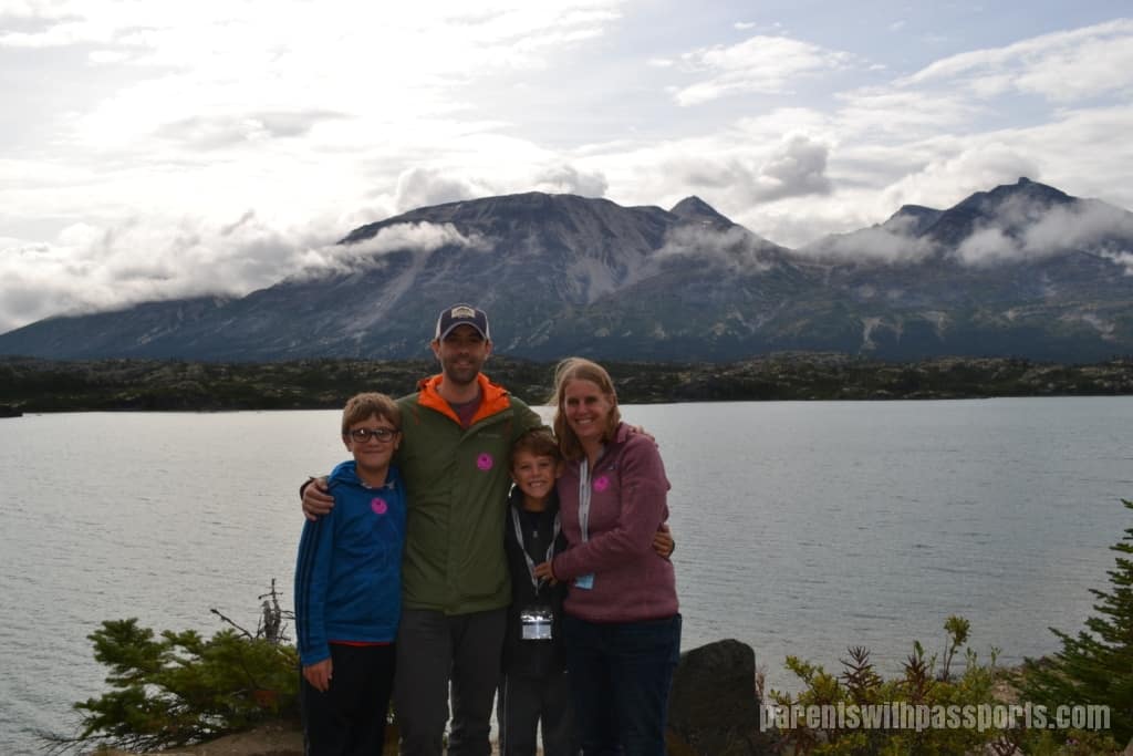
After about 2.5 hours of driving the Klondike Highway and making scenic stops, we arrived at Caribou Crossing. We spent a hurried but fun hour and fifteen minutes there before hitting the road again. (Read all about the Caribou Crossing stop here.)
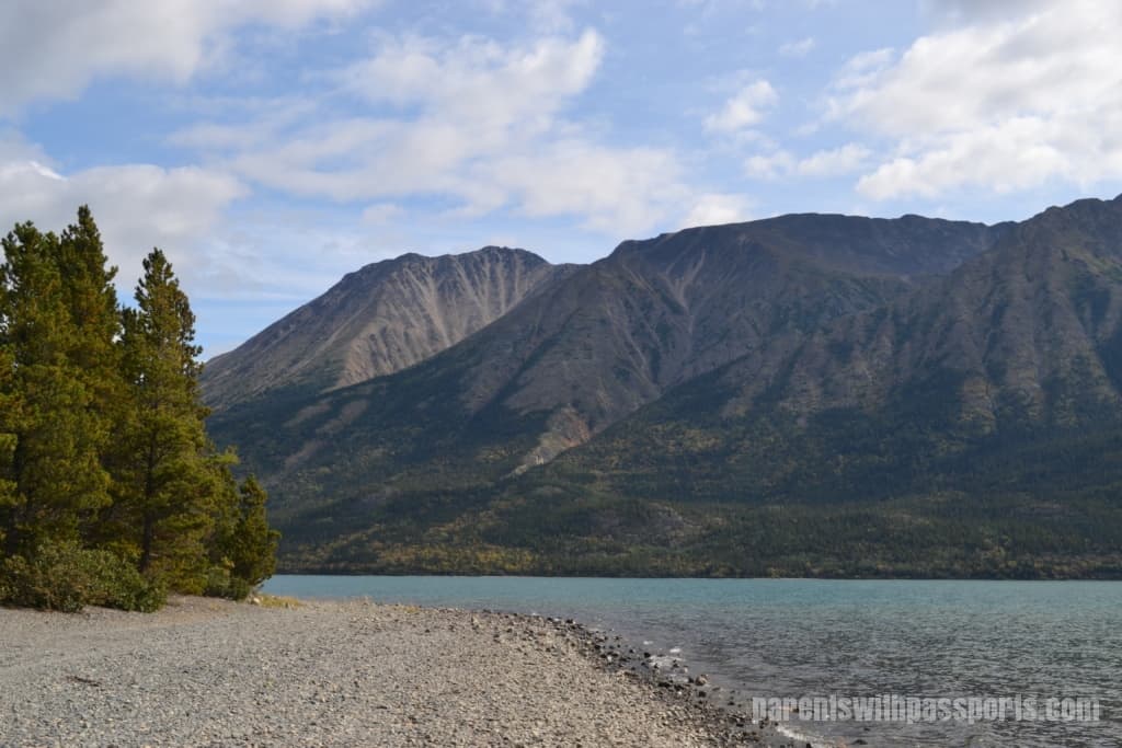
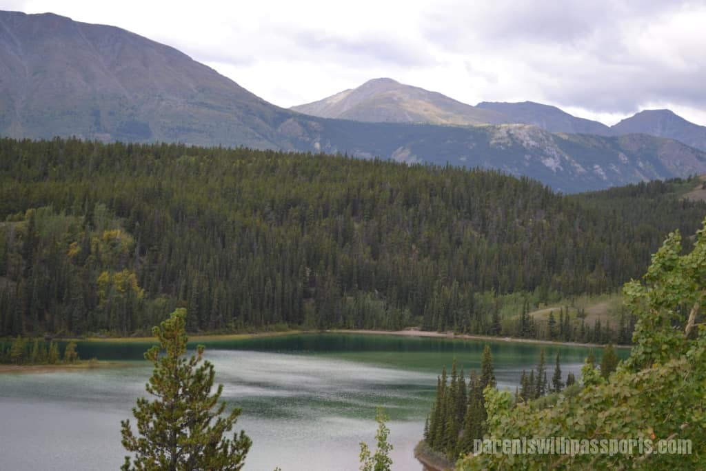
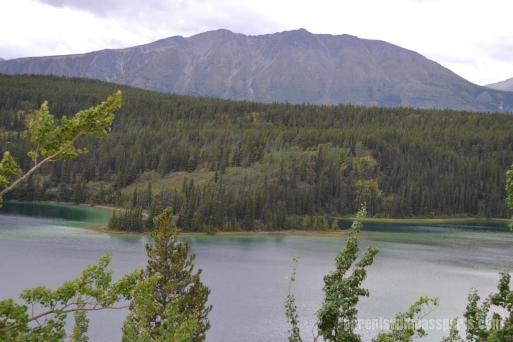
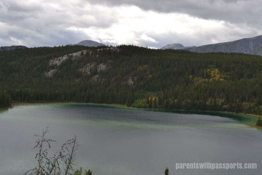
We had 3 stops left on our way back down to Fraser to catch the train. First up was Emerald Lake, a gorgeous lake with the Gray Mountain Ridge looming in the background. This was the third lake we visited, each one more stunning than the one before. Emerald Lake gets its name from its emerald green waters. The lake floor is covered with marl, a white calcium carbonate clay. The sunlight reflects off the marl and causes the water to appear green.
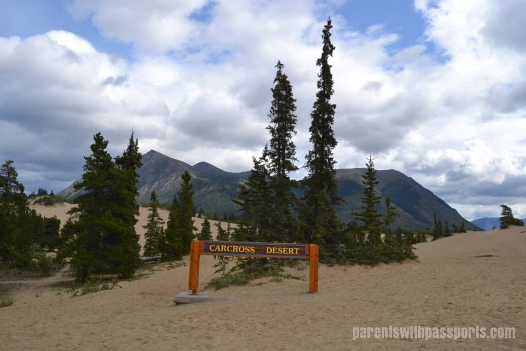
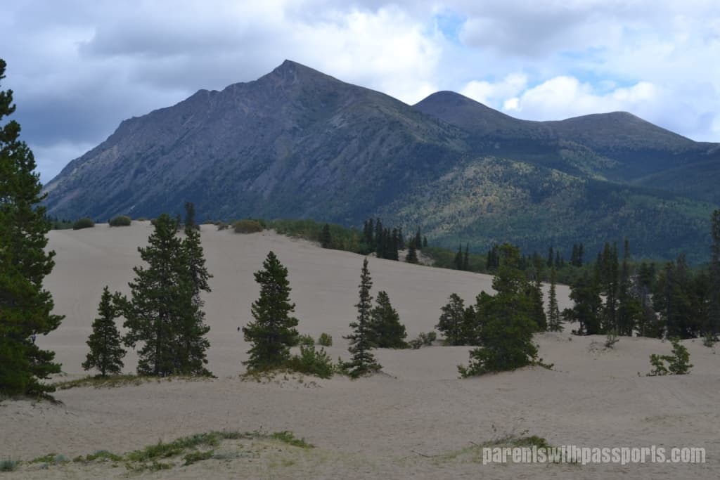
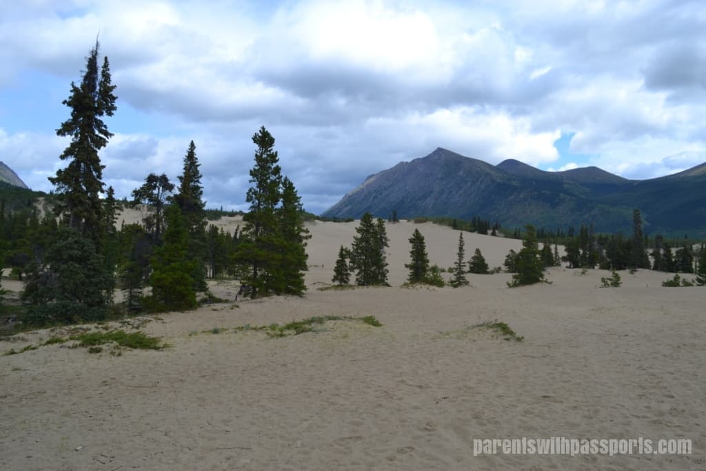
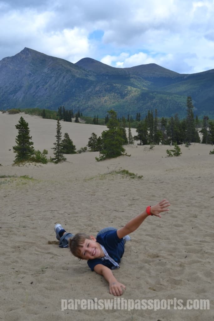
Our next stop was definitely the most unique of the many places we visited on our tour. After a seemingly endless supply of gorgeous mountains and stunning lakes, it was a shock to find the “World’s Smallest Desert” just a few miles away. Occupying one square mile in an otherwise subarctic tundra biome, the Carcross Desert is a geological oddity. About 10,000 years ago, glaciers here melted and formed lakes, which eventually dried out, leaving the sandy sediments from the lake floors exposed. Today this sediment stays exposed, thanks to intense winds off of nearby Bennett Lake.
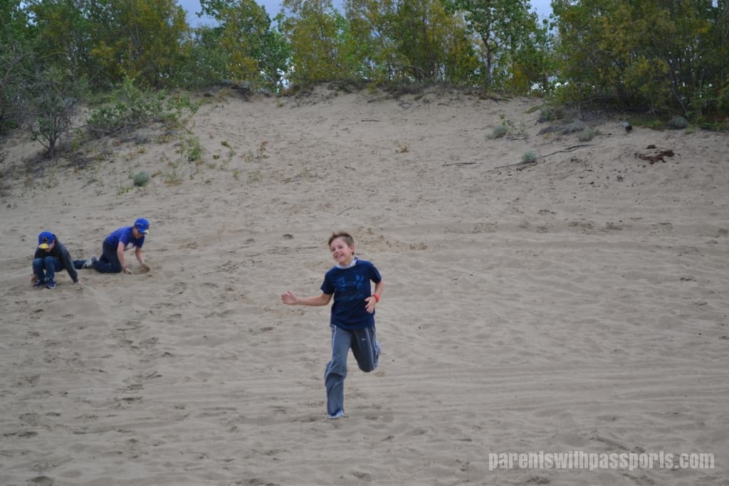
The Carcross Desert is such a bizarre phenomenon that it was almost difficult to believe it was naturally occurring. Especially when the area is blanketed with snow in the winter, it would be hard to imagine something more out of place than a desert in the Yukon. The kids absolutely loved the novelty of it and running around and playing in the sand.
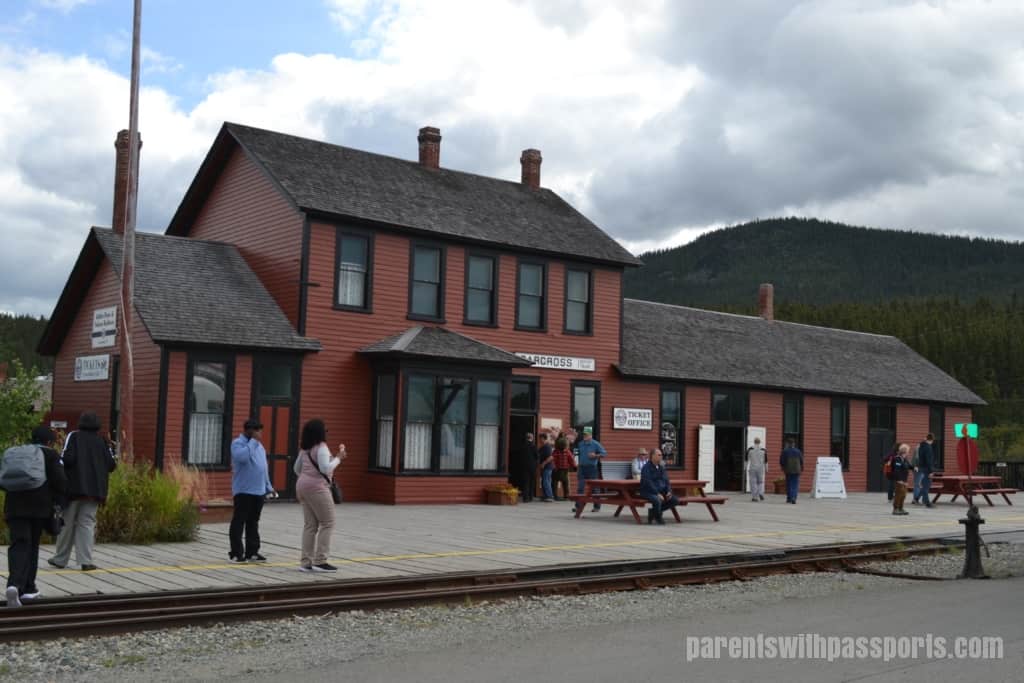
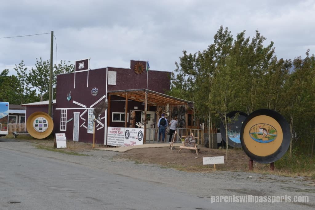
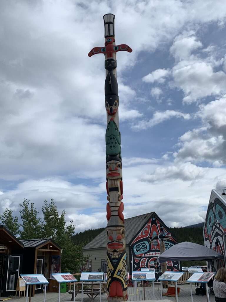
After the desert we stopped in the town of Carcross. Dating back to the gold rush, the town currently has roughly 500 residents. It offers First Nations culture, a White Pass railway station, cute shops, and delicious ice cream. We walked around for about half an hour before heading back to Fraser to catch the train.
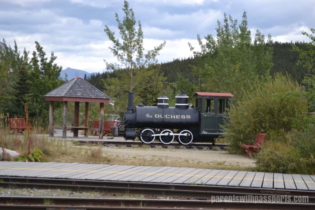
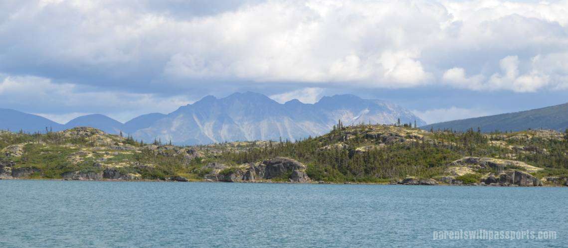
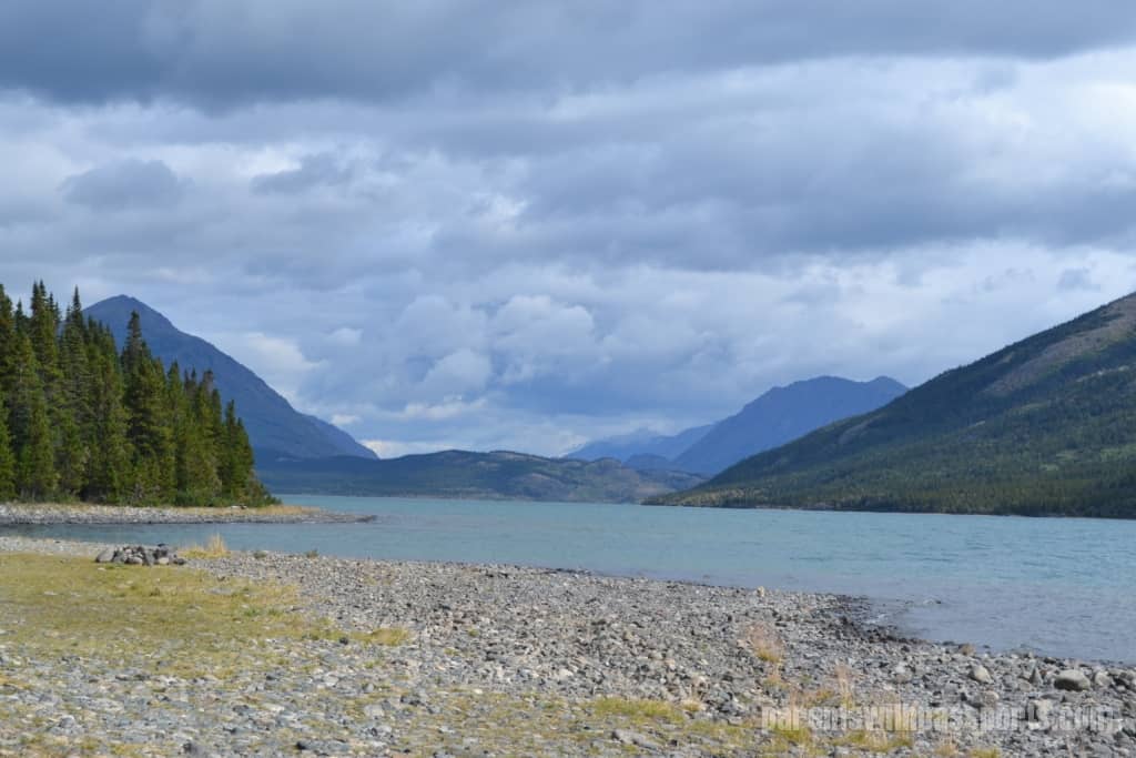
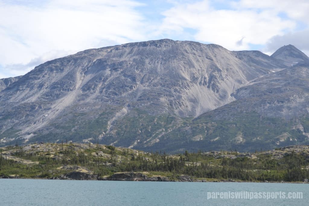
Finally it was time to catch our train for the scenic and relaxing ride back to Skagway. We had seen the train station from afar on our stop at Bernard Lake in Fraser. With the skies now clearer, we were treated to yet another incredible view of Bernard Lake. The colors really seemed to pop, as the blue water stood out against the yellows and greens on land.
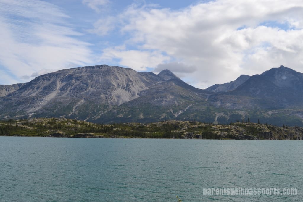
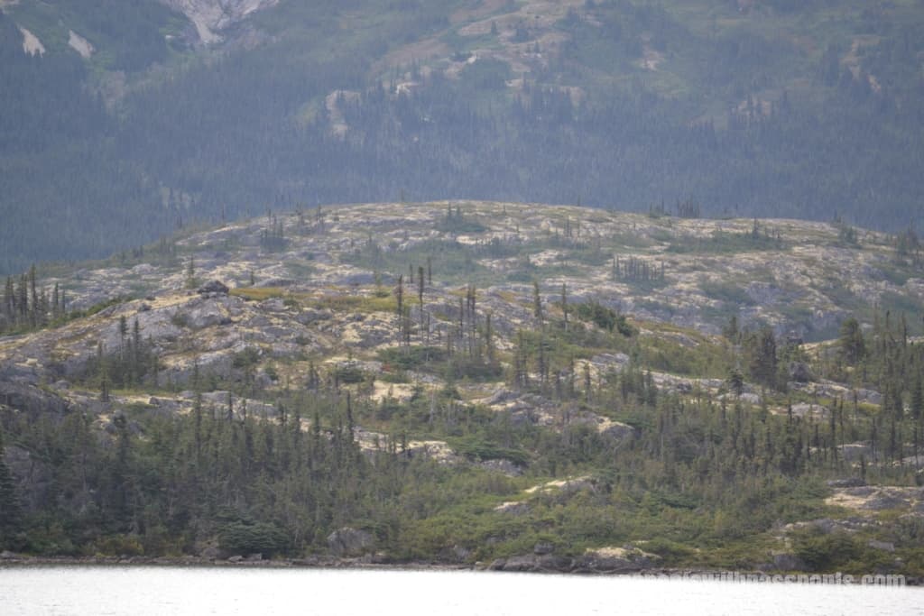
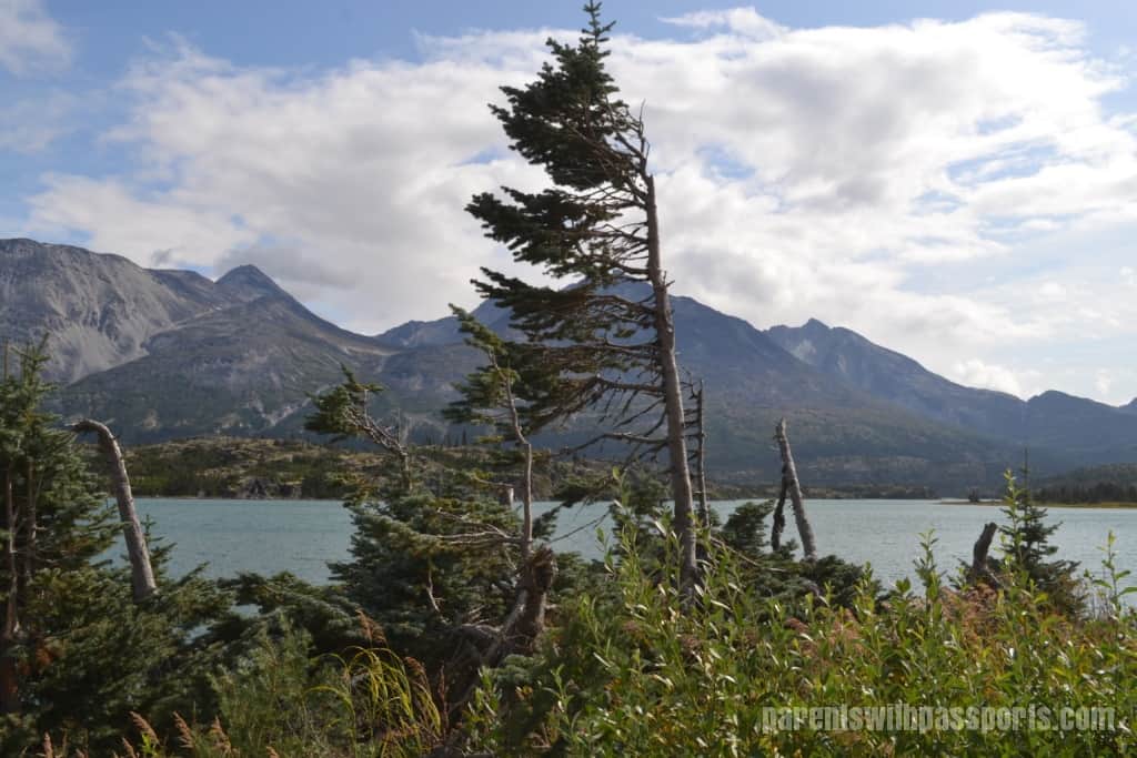
Again, the landscape was interesting in this area. Between Fraser and Log Cabin is an area known as “The Tormented Valley”. It consists of a sparse subalpine landscape that is dominated by rocks, giving it an almost lunar appearance. (It is often referred to as a “moonscape”.) From this vantage point, you could see the rocks and lichen starting to overtake the landscape and the trees that have been battered by the harsh winds and winter storms.
The view from the train station was the perfect ending to the bus portion of our trip. We had covered so much territory in our 6 hours so far and the scenery was more stunning than I ever could have imagined. Little did I know that it was only going to get better on the train ride back to Skagway…